Friday, December 24, 2021

Born to Wander

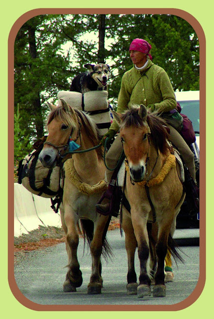
     Bye, Bye Bernice was my 2015 farewell post to a remarkable woman. Bernice Ende (aka Lady Long Rider) had spent the winter of 2014-2015 in Fort Edward and was preparing to leave as spring approached. Her time here was but a brief chapter in a long sea to shining sea journey that covered some 8000 miles over two and a half years ... all on horseback.

     Now it's time to say a final farewell. Bernice Ende passed away on October 2, 2021 at her sister's house in New Mexico. Over her lifetime she logged more than 30,000 miles with a number of horses and her beloved dog Claire. For more on her extraordinary travels you can read her book, watch a movie about her and visit a website which remains up for the time being. 


     Gwenne, Holly and I visited her several times in the winter she spent here. What always struck me was how she was more interested in our lives, in what we were doing, than in talking about herself. She was a thoughtful, contemplative person but couldn't easily explain why she spent days in the saddle, nights on the ground. On her website she does mention four reasons for her travels: To encourage female leadership. To discover, learn and grow. It's her personal version of the oft repeated justification for climbing mountains: "Because it's there".

     We all develop our own individual relationship with place. For most it's about finding somewhere secure and nurturing to live out our lives, to raise our families. But not for everyone. Somewhere deep in our DNA is the nomad gene that urges us to wander, to see what is beyond the next hill. It's what lead us out of Africa, to explore every nook and cranny of our world and even to venture into space. It may someday be the end of us as our travels are now fueled by spewing carbon into the air and have become so efficiently globe-spanning that we can spread deadly virus's in a matter of days.

     That's why I'm thankful for those who show us how to scratch the wandering itch simply, quietly while doing no harm. Thankful for people like Bernice Ende. 


     * Joni Mitchell's poetic sensibility touches on the deep stirrings that send us roaming. Here's a link to her Urge For Going.   

Sunday, December 19, 2021

Shushan Shining Bright


     I've been to Eagleville a few times in recent days, tidying up our woodlot before hard winter sets in. Strange to be working in a tee-shirt in mid-December with temps in the 60's. I usually keep busy until it gets too dark to see. That's around 4:30 pm (right about the time I would start baling hay in the summer!). As dusk fades into night I relax with some coffee and watch the Moon rise over Snake Ridge, listening for the hoot of an owl above the quiet murmur of the Battenkill.

     It's a monochrome world as I start the drive home. A patchwork of fields and woods washed in pale moonlight. Then it's down the hill into Shushan where things get a bit more colorful. For the unfamiliar, Shushan is a 'blink and you missed it' gathering of a few dozen homes at the spot where two county roads cross paths. It's a place where you can momentarily forget what century you're in. There's a certain timeless coziness about it and I make sure I don't blink when passing thru because it never fails to put a smile on my face. 

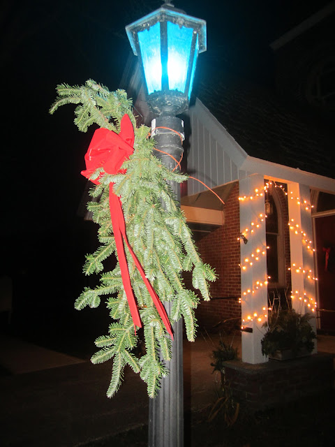
     In a world that seems slowly wobbling out of control, I savor Shushan's quiet steadiness. And in the holiday season there's the bonus of cheery Christmas lights. They lured me to stop the other night and snap a few shots. Unfortunately my dime store point and shoot doesn't do the scenes justice. But maybe they're enough to inspire your own ramble thru the winter hills, with their hidden treasure of sparkling color. 


Sunday, December 12, 2021

Over the creek...into the forest

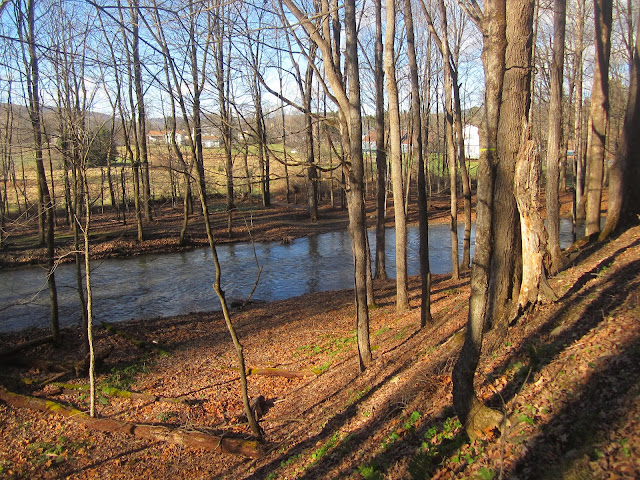
     I visited the Cambridge Community Forest for the first time recently. Right away I foresee a big problem. You have to cross a foot bridge over White Creek to access the woods, but the scene looking up the stream is so enchanting that it's hard to go any further. Visitors may never make it beyond this view unless they know there's many more treasures on the other side.


     The 140 acre property has been open to the public for less than a month but it has been several years getting to this point. The previous owners had managed it for timber production while also allowing the school to use the land for environmental education. When the property was put up for sale local citizens recognized a once in a lifetime opportunity. Fortunately, the Agricultural Stewardship Association, with financial support from the Open Space Institute and several other organizations and individuals, came to the rescue. ASA typically holds easements on farmland but in this case they have title and will manage the forest with help from a Friends group and volunteers. 


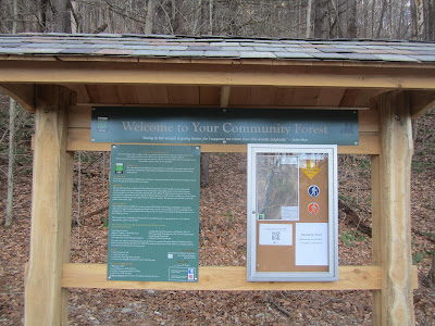
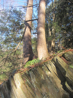
     If you can pull yourself away from the view of White Creek you'll come to an attractive kiosk (hewn timbers and a slate roof!). From there several marked trails branch off with many more planned. An easy, level path parallels the water. Whimsical signs attached to trees make this a natural playground for younger children. In short order you come to a tributary rivulet that was gurgling briskly downhill after a day of heavy rain. We headed up along it exploring the phyllite rock  ledges before eventually finding the den of a well-fed porcupine (judging by the copious scat at its entrance).


     The forest is a mix of white pine groves and open hardwoods with hemlocks higher up. I believe Jared Woodcock (one of the spark plugs behind the creation of the Community Forest) will be doing some horse logging here from time to time. That will be fun to see. There are some existing skid roads from previous harvests. They are wide enough and just the right grade to make great ski runs. Bring on the snow!


     What's also intriguing is the possibility of a connecting trail between the Community Forest and the Mt.Tom State Forest which lies just a ways to the east. Wood products, wildlife and quiet recreation are the bounty of these rugged Taconic hills.


     Cambridge has long been one of my favorite destinations for running and biking, for paddling and swimming. The Community Forest just makes it that much sweeter. And speaking of sweet, if you go on a Sunday morning be sure to stop at Kings Donut Cart. We picked up some amazing almond and walnut croissants. The farmers market is on Sunday as well. There's also a brew pub, several restaurants and a number of interesting shops in town. It takes a village (especially one with a community forest) to make a great getaway. 


web image


     Note that you park a short ways from the bridge and walk down Rockside Drive to enter the forest. Turn off Rt. 22 onto Rt. 313 and the parking area is a quick right turn (see map on right). On the trail map at left the blue and orange trails are marked and easy to follow. The green trails are planned for the future so wandering up there would be more of a bushwhack at this time.

     Here's a link to a video about the forest.


Tuesday, October 26, 2021

'Til Ti

      A dark night. A knock on the door.

      So begins a ghost story that stretches from the Highlands of Scotland to a cemetery in Washington County.

     Duncan Campbell opens the door of his tower house on the banks of the River Awe to find a desperate man with blood besmirched clothes.  The midnight visitor pleads for shelter. He claims men are pursuing him with evil intent. "Swear on your dirk that you will protect me," he implores. Such is the code of conduct in the 18th century Highlands of Scotland that Campbell must pledge to harbor this unwelcome guest and reluctantly guides him to a hidden room for the night.

Inverawe House - Scotland
web image

     A few minutes later comes a second knock and Campbell is confronted by a group who tell of a heinous murder. Donald Campbell, his clansman, has been cut down in an ambush and robbery. Had Duncan seen anyone suspicious?
     Talk about being caught between a rock and a hard place. The Highlander stood pinned between his oath to harbor the fugitive and wanting justice for his slain cousin. The honor of his word won the moment and he told the men he had seen no one. But later that night, as Campbell tossed in troubled sleep, he had another visitor. Donald's ghost stood by his bedside and intoned, "Inverawe! Inverawe! blood has been shed. Shield not the murderer!"
     In the morning Duncan settled on an uneasy compromise. He lead the man out of his house and up the wild slopes of Ben Cruachan. There he hid the scoundrel in a cave and felt he had satisfied his oath. But the following night the ghost returned to beseech, "Inverawe! Inverawe! blood has been shed. Blood must avenge blood." 


Ben Cruachan - Scotland
web image

 
     The following day, feeling no longer bound by oath and under heavy obligation to Donald, Duncan went to the cave intent on avenging the murder. But the villain was gone leaving him no recourse but to return to his castle on the River Awe where his sleep was disturbed yet a third time by the ghostly apparition. But this time the words were different and perplexing, "Farewell Inverawe! Farewell, till we meet at TICONDEROGA!"
     Neither Campbell nor anyone else in Scotland had ever heard of Ticonderoga but the name stuck in his mind roiling and agitating. Then, in 1758, he found himself in America, a Major in the fabled Black Watch regiment of soldiers fighting with the English against the French for the control of a continent. In early July of that summer the Black Watch embarked down Lake George from the ruins of Fort William Henry, members of a huge army under the command of Major General James Abercromby. Their objective was to attack the French at Fort Carillon (now Fort Ticonderoga) on the shore of Lake Champlain.


web image


     Upon reaching the north end of the lake the plan began to unravel. Field commander Lord Howe was killed in an early skirmish and Abercromby then hesitated allowing the French time to build a formidable breastworks in front of the fort. Meanwhile, Duncan Campbell heard others speak of the looming attack on 'Ticonderoga' and that word filled him with apprehension. A final visitation by his cousins ghost followed and by the time the British moved against the French, Campbell knew his end was near.


     The provincials, British regulars and particularly the Black Watch showed great bravery but the cards (and trees) were stacked against them. From their lines behind a wall of fallen logs the French were able to target the exposed open field position of their enemy. By the time Abercromby finally called off the futile charge nearly 2000 of his troops were killed or wounded. Among them were both Duncan Campbell, shot in the arm, and his son Alexander, also with an arm injury.


The Black Watch at Ticonderoga
web image


     The horror of the battlefield was followed by the horror of retreat. In disarray the soldiers had to find their way back thru dark woods to their boats and then row some thirty miles back to the head of the lake. From there it was a rough overland trek to Fort Edward where a crude hospital on Rogers Island awaited. With neither anesthesia nor antibiotics one can only imagine the pain and suffering of the wounded. Duncan Campbell had his arm amputated but to no avail, he died on the island July 17, 1758. His son fared little better, making it back to Scotland where he died of his war injuries. The ghost's dire warning about 'TICONDEROGA' had come to pass.


State Street Cemetery in Fort Edward


     Campbell's body was laid to rest in what is now Fort Edward's State Street Cemetery. But it was not to be undisturbed rest. In 1871 he was exhumed by Walter and James Gilchrist for the purpose of reburial in Union Cemetery several miles away. The Gilchrists, out of macabre curiosity, opened the coffin to see what old Duncan looked like after all those years. They were surprised to find a body that appeared almost freshly buried, but perhaps more surprised when after a few minutes of exposure to air the corpse turned to dust before their eyes.


web images


     Even after subsequent internment the saga wasn't over. Due to vandalism of his grave Campbell was dug up again around 1927 and now lies in an enclosure that also contains the remains of Jane McCrea and Sara McNeil. To add one last bizarre twist to the story, McCrea, who was also moved several times, was exhumed yet again in 2003 when it was found that her skull was missing, apparently taken by souvenir hunters at an earlier reburial. Who needs haunted house attractions when you have local history like ours?   


IN CAMPBELL'S FOOTSTEPS...


     It's possible to visit all the places mentioned above. Heading to Scotland sometime soon? Why not swing by Inverawe House. I believe it has gone out of the Campbell clan's ownership and is now known for it's smoked fish and meat! It's not to be confused with nearby Inverary Castle which also has its share of ghosts. While in the Highlands you can climb Ben Cruachan being careful to avoid any hideaway caves. 


Inverawe House
web image


     Back in the States you can visit Fort William Henry and the Lake George Battleground Park, both located at the south end of the lake with lots of interpretive material. This is where Abercromby assembled his 15000 strong army and built the bateauxs and whaleboats to transport his troops north. At the far end of the lake, Fort Ticonderoga is a major attraction where you can walk the battlefield that Campbell fought on. The Black Watch are still revered here with the local library named after them and a memorial  on the fort grounds.


Web image of Black Watch Memorial


     In Washington County you can stroll on Rogers Island where the hospital that Campbell spent his last days in was located. There's also a visitors center with exhibits on the islands military history. The State Street Cemetery is located in Fort Edward Village and Union Cemetery is a few miles up Rt. 4 across from the Washington County DMV and offices.


     Two other sources that you might want to check out are Frederick B. Richards' The Black Watch at Ticonderoga and Major Duncan Campbell of Inverawe and Robert Louis Stevenson's famous telling of the Campbell tale Ticonderoga. Both are best read on dark stormy nights. Just hope no one knocks on the door while you're engrossed in Duncan Campbell's world.
Tuesday, September 28, 2021

Mosey on the 'Kill

     A riddle: Where did boats once float over the top of other boats?

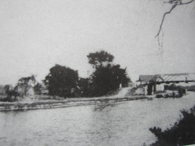
     And the answer is: On the Moses Kill in Washington County where an aqueduct carried the Champlain Canal and its barge traffic high above the creek and any canoes or rowboats that were on the stream below. 


Then...


...and Now

     Today you can be in one of those canoes below, but you'll have to use your imagination to have a canal boat float overhead. It's just one of the many small pleasures to be enjoyed on one of my favorite paddle trips.
     Time for another riddle: What stream that's totally in Washington County is best approached from Saratoga County? The answer is once again the Moses Kill and the explanation is that there's no good launching point where the 'Kill joins the Hudson in the Town of Fort Edward. More on this later but for now I'll describe a recent trip where I started from West River Road in the Town of Northumberland, Saratoga County.
     Heading north on Co. 29 (West River Road) just past Wells Lane  you can see the Moses Kill entering the Hudson River on the east side. There is NYS Canal Corp land here and I usually park on the left (west) side of the road where a sloping shoulder is possible but not ideal. Carry your boat across the road and look for an open spot down the short, steep bank where you can get to the water. Once you're afloat it's a quick crossing of the Hudson to the mouth of the Moses Kill. Don't go downriver because there's a dangerous dam/falls. Stay well above a line of buoys and you'll be fine. Do take note of the Barge Canal entrance on your right. It's a source of motorized boat traffic but also another possible approach to the Moses Kill.

The Moses Kill meets the Hudson just below the Rt. 4 bridge

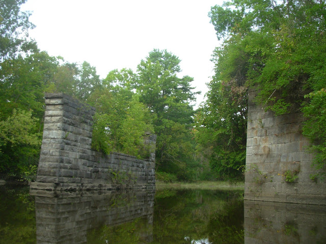
     You enter the 'Kill by paddling under the Rt. 4 bridge. It's just a level stretch of the busy road supported by huge beams. Most drivers probably don't even know they're crossing water. Too busy Texting. Just beyond you'll see stone block abutments. This is a former Rt. 4 crossing site but the bridge is long gone. In the past people have accessed the creek here on the north (left) side but it has become overgrown and dangerous to pull-off the highway thru an opening in the guardrails. On the south side Richardson Lane comes off Patterson Road right up to the stream bank. While there is one private residence here, New York State owns much of the surrounding land. This would make an ideal launch site. With a quiet public road and public land already existing, all that's needed is a designated parking spot and a short path to the water. Zero cost and safe, convenient access to a wonderful natural and historical resource. I hope it happens but I'm not holding my breath.


Old abutments and Richardson Lane off Patterson Road.

     Beyond the new/old Rt. 4 crossings the stream takes on a wilder character. Low lying shores are lush with aquatic vegetation and silver maple groves lie a little inland. This is the realm of herons overhead and turtles tumbling off every log. Birders and plant lovers will be tempted to linger but those who push a little further upstream are in for a treat. Two artifacts of transportation from another era cross the creek one after the other.


     First you encounter the cut limestone piers that held up the Champlain Canals Aqueduct #4. The canal boats traveled over the 'Kill in a wooden trough with a towpath alongside. This no longer exists but is easily visualized. The water to fill the canal came from up by Fort Edward which is that much higher than where you float in your canoe. There was a lock off to the right that acted like a stair step to raise the boats from the Fort Miller level to the Fort Edward level.


     Will Patterson operated a store here and there was a school where Susan B. Anthony taught. A boat basin where repairs were made adjoined the canal. There was even a haunted house that the boaters feared passing at night! In the late 1800's this was a busy place, much more open and developed than what you see today. Curiously, at one time the settlement was called 'Mock'. Along with an accessible canoe put-in, an interpretive panel detailing the history and layout of the former Moses Kill community would add to the enjoyment of a visit. 


     From the aqueduct it's a short paddle to the next "Wow" moment as a graceful cement arch bridge comes into view. This structure carried the Hudson Valley electric trolley line over the water. It was built around 1900 and transported passengers from Troy to Lake George (and possibly on to Warrensburg?) for nearly thirty years. I believe it ceased operation after damage from the 1927 flood. In 1904 a round trip from Johnsonville to Lake George by train and trolley included a cruise to 14 Mile Island aboard the Horicon steamboat, all for $1.00! There was a substation of the line here at Moses Kill, while perhaps the best place to see the preserved bed of the trolley line is at the Denton Preserve off Rt. 4 between Northumberland and Fort Miller. Also visible at Denton are remnants of the old canal.


Was this oddly shaped building the H-V trolley substation?
I'm really not sure.


The three photos above are from an early spring trip to Denton Preserve.
You can see the trolley bed, a pole holder and a piece of glass insulator.


     After paddling beneath the arch bridge (good for echoes) the shoreline begins to change. Shale ledges frame the channel with pines and hemlocks towering above. Here the 'Kill has cut a small, narrow gorge thru the bedrock. In a couple of places the water is so shallow you may have to get out and lift your boat (wear old sneakers) but it's worth it to continue up to a T where Dead Creek comes in on the left and the Moses Kill turns right. You can go further on both streams but much depends on water levels, log jams and your own sense of adventure.


     My return trip back towards the Hudson felt like time travel. I imagined 450 million years ago when the Taconics were rising up high and mighty just to the east. Their barren slopes shed sediments into a deep, broad trough filled with sea water, the result of colliding plates buckling the crust of the earth downward. Over many millions of years the mountains eroded and the trough filled with mud that became the shale that I was drifting over and through. Originally horizontal, these rock layers now lay at crazy steep angles, shoved and twisted by the tectonic forces of a restless planet.

Shale outcrops with tilted bedding are found thru out the Hudson Valley


     Eons later glaciers buried and scrapped the land. When the climate warmed and the ice waned great muddy lakes formed. After these post-glacial lakes drained, the clays that had settled to their bottoms formed rich soils lush with vegetation but also imparted a cloudy character to the streams that flowed across them.

In this google earth screen shot notice the difference in color of 
the clay laden Moses Kill where it enters the clearer, darker Hudson River.
West River Road in Saratoga County (my put-in) is on the left.
Richardson Lane approaches the stream from Patterson Road at the bottom.
Look closely for the aqueduct abutments and trolley bridge upper right. 


     Over time the waterways and woodlands filled with fish, fowl and wildlife and these in turn attracted the first paleo-indians. Tom Ellis, who farms near Dead Creek and the Moses Kill, has an interesting collection of stone points that have turned up as he worked his fields, testament to the natives who once fished and hunted here. When you're in a canoe silently gliding below high, forested banks it's hard not to look over your shoulder a little nervously, wondering about and maybe watching for those who once roamed these parts.


     At one point in the shale gorge a trickle of water seeps down the rock wall. It has left a light deposit that has the unmistakeable odor of a mineral spring. With the sites of the Vita and Lick Springs just to the east and the famous waters of Saratoga not far to the west, I wonder if this fount has the same source? It wasn't long ago when springs like this were popular gathering spots drawing people by the hundreds.
     The trolley arch, canal aqueduct, old bridge abutments and modern highway span are passed in quick succession. Each speaks of evolving transportation technology and the lifestyles it fostered. Finally my little canoe inched out into the broad Hudson just as a speed boat came zipping down river. I experienced a brief moment of panic before they saw me and graciously slowed to a crawl. Nothing like the threat of being torpedoed to snap me back into the present after my tour of times gone by.


     * All the historical black and white images in this post come from a delightful little book called The Champlain Canal: Mules to
 Tugboats by Captain Fred G. Godfrey. It's in local libraries and you can purchase a copy from the Washington County Historical Society in Fort Edward.