It was a perfect winter day. Blue sky, bright sun, mild upper twenties.
Perfect, except...there was no snow.
Normally Gwenne and I would head out for a ski tour on a nice Sunday in January. Do a little exploring, look for someplace new. But not this year, not on bare ground. So, no skiing but maybe we could still do some exploring, find someplace new.
Sometimes you just have to cast off, get moving, be open to whatever. We paused at the end of our lane, a moment of indecision, then headed south. Soon I started to notice things. A Knox monument at Starks Knob. Then another in Schuylerville and later a third in Stillwater. Made a note to myself: do a little research into the events they commemorate. Then there was the trail work along the old canal towpath beyond the Schuyler House. Was this part of the Empire State Trail? Have to look into that. Going by Coveville I remembered how I'ld always wanted to paddle the odd little appendage to the Hudson's shoreline. Was it an old glacial meltwater channel? Not sure but it would be fun to find out. Further along we passed a couple of boat launches offering easy access to the river. Put them on the list for next summer.
Stillwater presented a choice. Continue south to check out Peebles Island, or cross the river here and see what we could find to the east. Rensselaer County is something of terra incognita to me so east got the nod. The Lock 4 park beckoned. It's an interesting place but I've been there several times before. We drove on, paralleling the Hoosic River before gradually ascending up onto its glacial delta. Interesting to note that both the Washington County Fair and the Schaghticoke Fair are located on identical landforms: level, well-drained gravel deltas deposited in glacial Lake Albany.
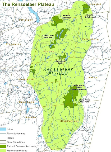
We crossed the Hoosic at Valley Falls trending south on a long, lovely stretch beside the Tomhannock Reservoir. Then the way lead up onto the Rensselaer Plateau, a high, hilly area that's part of the Taconics. Pushed here from the east during the orogeny 450 million years ago, it's noted for outcrops of graywacke, a hard sedimentary rock originally deposited in deep marine basins by turbidity currents.
We continued to gain elevation, eventually coming to the small village of Grafton. Here there were signs pointing towards something called The Peace Pagoda. Gwenne looked at me. I looked at her. Neither of us had ever been to a Peace Pagoda before. Who knew when we'd get another chance? We followed the signs.
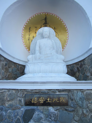
Higher, deeper into the woods. Along dirt roads, past stone walls. Then there was a sign: 'Park Here' with a lane leading off to the right. Another sign suggested a trail wandering into the forest. We took the trail, followed hand painted arrows, wound over rocks and around boulders. Soon enough we could see a dazzling glow as the afternoon sun reflected off something beyond the trees. When we finally stepped into a clearing, there it was ... our first, our only 'Peace Pagoda', magnificent in the late-day light. It was a revelation. To come on to something like this so unexpected in what could charitably be called the middle of nowhere.
We spent an hour, maybe more, walking around the Pagoda, taking in the life of Buddha as celebrated in signs and bas-reliefs. We found other monuments on the grounds and looked into the adjacent temple where services are held twice a day. We learned of Nichidatsu Fujii and Jun San and Hank Hazelton's roles in creating the Pagoda. Finally, we walked back down the trail, glad to have gone exploring and filled with wonder at what we'd found.


Excellent!
ReplyDelete