I guess she found me less than perfect. But, that was a long time ago. Now I'm much improved and I can smile at her clever put-down. It comes to mind whenever I'm near the Champlain Canal. I think of this overachieving little ditch as Washington County's wagon rut. And what a fine rut it is, with water, life and stories. Maybe even a few snake's belly's.

What the canal does is connect Lake Champlain to the Hudson River, creating a north-south route between the Atlantic at New York Harbor and the St. Lawrence Seaway, outlet of the Great Lakes. Along with the east-west oriented Erie Canal it offers cruising access to the rest of the world. It would be possible to launch your boat in, say, Fort Ann and sail away to the Sea of Japan, should you desire to have North Korean missiles rain down upon you.

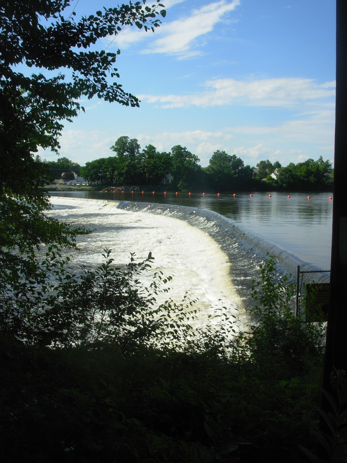
Dams

And locks
There are eleven locks in the sixty mile length of the Champlain Canal. Since my cruising yacht and the leisure to use it continue to prove elusive, I won't be needing a lift thru one of them anytime soon. But even the boat-less among us can enjoy a visit to the locks. I hope to do a post on each of them, if the creek don't rise.

The first few locks are terra incognita for this farm boy. They are more than a half hour from my home, and lie in the direction of cities. Ugh! But I did visit Lock 4 this summer. It's a stone's throw from the southwestern corner of Washington County and can be reached by a pleasant drive down River Road, aka Co. 113. Its access lane even skirts a soybean field. My type of place.


Lock 4 locust
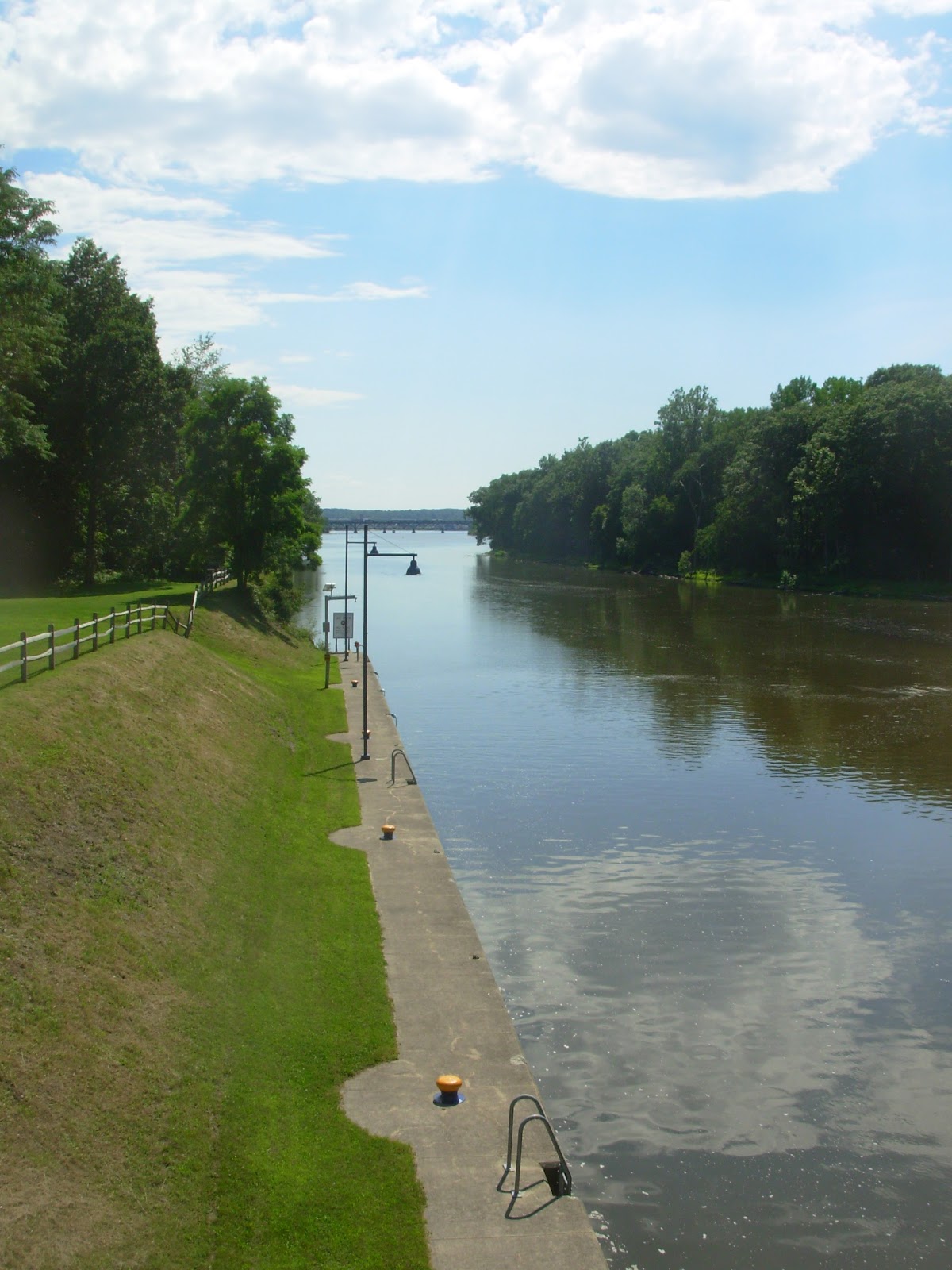
Looking south from Lock 4
The locks make a great first impression. They are neat and well maintained, park like. On the day we visited kids were riding bikes and people were fishing, walking dogs, taking photographs. We found trails, unmarked but obvious, that enter adjacent woods and lead to a point where the Hoosic River enters the Hudson. There's a nice variety of trees here with a slightly southern feel - oaks, sycamores, silver maples and cottonwoods. At the tip of the peninsula you can see the paper shale bedrock that has been tilted from the horizontal by tectonic forces. There are also muddy alluvial areas with thick growths of semi-aquatic plants waiting to be identified.

From the cliff-top trail you look out upon several islands and spot a railroad bridge downstream. Beyond that is the Mechanicville Dam and Lock 3. With a canoe you could explore the two mile long pool between the locks.

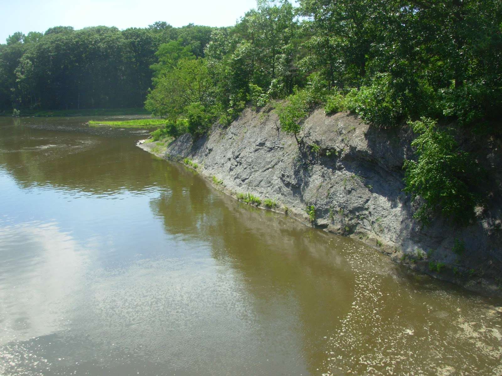
Particularly attractive is a path that follows the Hoosic a short distance upstream. It winds high above the river with a number of scenic overlooks. Below, the water drops over several low ledges in a shallow gorge. You wouldn't want to paddle up against the current but with the right conditions a trip downriver from below the falls in Schaghticoke might be fun. Just do your diligence and carefully scout the route before attempting it.

The Hoosic looking upstream

The Hoosic's last hurrah is at Schaghticoke. In post-glacial times it built a large sandy delta here. Today it has cut down thru those deposits and into bedrock creating an impressive gorge with interesting geology. This stretch is also rich in Native American history. For further info check out the Hoosic River Watershed Association and Lauren R. Stevens' "Dispatches from the Beyond Place".

After our hike along the Hudson and Hoosic we got back to Lock 4 in time to watch several boats pass thru. To wonder where they were going. You know the feeling when you're hungry and you catch a whiff of something delicious being grilled? Sweet torment. The canal is sort of like that for those of us with wanderlust. There's something about watching a boat with a long ribbon of water stretched out before it. It speaks of freedom, the lure of escape and finding out what's around the next flowing bend.

DETAILS...
The road leading to Lock 4 is gated at 4:30 pm. If you want to visit later in the day look for a dirt lane on the narrow strip of land between the river and the canal. Drive or walk down this a ways and cross the canal on the railed top of the lock gates. There is a long, lovely stretch of river between Lock 4 and Lock 5 (above Schuylerville). There are several access points to this section, all in Saratoga County. Stillwater has a river side park with trails and a picnic pavilion. You can launch canoes and kayaks there. A little further north along Rt. 4 you'll see a graveled ramp suitable for trailered boats. Also available is the commercial marina at the Cove. I don't know of any access on the Washington County side. Kind of disappointing. Rt. 4 and Co. 113 make a nice bicycle loop tour though. You could start at Lock 5 and take a lunch break at Lock 4 before heading back to Schuylerville for post-ride refreshments. Perfect way to spend a fall day.


Opening doors to who knows where
No comments:
Post a Comment