"When they go low, we go high."
- Michelle Obama
Maybe we needn't tell Barack, but it's no secret that I'm quite smitten by his wife, the First Lady. Her wit, style and spunkiness are the initial attraction. Then, as you get to know her better, you see how kind, decent and genuine she is. For someone like Michelle Obama to rise up out of the dark swamp of Washington - well, that's a gift. And while I don't necessarily agree with all her husbands policies, I do respect his intelligence and sincerity. He tried to do what he thought best for the country in an impossible atmosphere of obstruction, meanness and even hatred. And he had the great, good sense to marry Michelle!

Surprisingly, Mrs. Obama's noble manifesto turns out to be good advice for exploring the Battenkill State Forest. As I mentioned in an earlier post, almost all the visitation here is down low, near the Eagleville Covered Bridge and a river access point nearby. But most of the Forest lies across Rt. 313 and up into the mountains beyond. If you are looking for solitude, for Wendell Berry's "The Peace of Wild Things", it might be a good idea to heed "When they go low, we go high" and head up into the backcountry.
That's what I've been doing for years now. I remember doing tough trail runs with Holly where the only thing that kept us slogging up the steep sections was the promise of a cooling dip in the river at the end. Other years, when we had good snow, I've skied up on the ridge, adding my tracks to those of a variety of wildlife. And most recently, Gwenne and I hiked up last winter with just a dusting of white on the ground.

Begin your exploration at a grassy parking spot about five miles east of Cambridge on Rt. 313, across from Eagleville Road. An old farm lane leads uphill with former fields on the right being managed for wildlife by the DEC. Pieces of abandoned equipment speak of the lands history from forest, to cultivation, back to forest.

Across a small stream-bed you'll see Battenkill Valley Outdoors. They are a great resource for adventures in this part of Washington County and nearby Vermont. They outfit river trips and provide shuttles, operate a retail store and even offer lodging. Last time I checked Don and Lisa Otey were running their business during the warmer months and then lending their talents over at Willard Mountain during the ski season. Contact them for expert advice on paddling, biking and hiking in the area.

Battenkill Valley Outdoors

One-eyed Jack watches the trail
A little ways further the trail crosses the stream on a footbridge. Look for an interpretive sign with information on the landforms you're hiking thru. When we were here the clear stream was busily dancing over rocks and stilling in small pools. Lower down there was nothing but a ribbon of ice whispering an occasional gurgle. Before reaching 313 even the ice vanished leaving a dry, cobbled bed. The explanation for this disappearing act is in the soils and their glacial origins. Up high the soil is thin till over shallow bedrock. Drainage flows on top of the rock and appears as a flowing stream. As it descends the stream encounters soils developed in deep outwash deposits of highly permeable sand and gravel. These absorb water like a sponge and the stream simply disappears in all but extreme events and heavy spring run-off.


Soil Map of Battenkill Valley and border uplands
Yellow (11) - shallow till on uplands
Pale green (22) - deep, gravelly glacial outwash in valleys
Dark green (25) - deep, silty recent alluvium along streams


However you choose to ascend, the goal is to attain the ridge top. If you stay on the trail you'll loop into Goose Egg State Forest for a bit and cross between the Towns of Jackson and White Creek - probably without knowing it. Look east for filtered views of Mt. Equinox and notice depressions that hold water for a short time in spring - vernal pools. Continue on the trail to its end at an overlook with views of the Battenkill Valley and southern Washington County. Snake Ridge slithers westward towards Cambridge, gradually losing elevation. It would be fun to explore it all the way to the village, but it's private property so this is the turn around point. What you can do is backtrack a little, wandering right thru open woods up onto Goose Egg Ridge, which is a little higher and offers views of the White Creek Valley.

Top of the Folded Rock Trail

Chestnut oak is a tree of dry places (xeric habitats) and you can find them up here. Look for deeply furrowed bark and a leaf with many wavy teeth. These differ from the fewer scalloped lobes of red oak leaves (pointy) and white oak (rounded). Similarity to the leaf of the American Chestnut gives this tree its name. It produces one of the largest acorns of the oaks, favored by wildlife, said to be sweet and recommended for roasting.


Forest ecologist Neil Pederson has cored trees up on these ridges and his results are surprising. Some of these trees are quite old - in the 200 - 300 year range. Forester Ron Cadieux thinks some of the stands on Goose Egg Ridge may be old growth with few signs of logging. Apparently the steep slopes have left them isolated and protected. But don't expect a grand forest of towering giants. The infertile, droughty conditions limit growth. Still, it's fun to walk the woods and imagine a time when these very trees shared a landscape with just a few Native Americans.

Today these hills are noted for their bobcat and bear populations. I've heard stories of bears coming out of the woods and walking across the covered bridge to raid bird feeders in Eagleville!
Deer are common and can be a hazard to motorists, especially in the evening. There are also foxes. This spring I enjoyed watching a den of pups frisking and lolling in the sun, all within sight of the hamlet. And yes, people do see Eagles along the river in Eagleville.

Caution: Bear Crossing
You can go up and down the Folded Rock Trail in a couple of hours or less. If you've got more time and energy there's a loop I do as a run, bushwhack and hike triathlon. Start by going up Murray Hollow on a lovely dirt road that twines with a zippy little stream.


Shortly after crossing the state line look for a "four-way intersection". No traffic lights or stop signs needed here. Take a right on an eroded, abandoned track. Go up and over the height of land, descending down to what becomes Bates Road till you see a sign for Goose Egg State Forest. Follow a path to the right, eventually going trail-less to the top of the ridge at 1927 feet. From here you can explore the rest of Goose Egg Ridge or drop down the north side till you find the trail back to the 313 parking lot. If you feel the need to get higher your best bet is to make the short hop to Vermont where they're still flirting with the idea of recreational marijuana.
* * *
Philip Embury was buried here...and here...and here...
Before getting in your car take a minute to cross Rt. 313 to the wooded corner with Eagleville Road. Look carefully and you'll see several stones in disarray. It helps if the leaves are off and there's no snow on the ground. This small, forgotten cemetery is the final resting place for two of Philip and Margaret Embury's children.


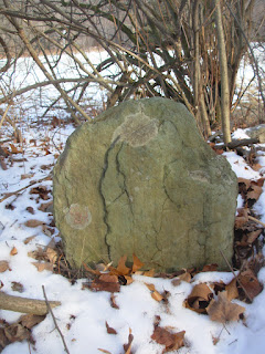
Before getting in your car take a minute to cross Rt. 313 to the wooded corner with Eagleville Road. Look carefully and you'll see several stones in disarray. It helps if the leaves are off and there's no snow on the ground. This small, forgotten cemetery is the final resting place for two of Philip and Margaret Embury's children.

Philip Embury was an important figure in the early history of the Methodist faith in America. He immigrated from Ireland in 1760 and settled in New York City for nine years. While there he built a church and started what may have been the first Methodist congregation on this side of the Atlantic. In 1769 he came north to Camden Valley near the Vermont border. He worked as a carpenter and farmer during the week and preached on Sundays. He died of overwork? or an accident? while mowing hay on a hot August day in 1773? or 1775? (sources differ on these details).

Philip Embury
At the time of his death Philip had been building a house for his family near the present day intersection of Eagleville Road and Rt. 313. His widow Margaret moved there with her four surviving children (two had died previously in New York City). Sadly, little Ana (age 6) and Philip (age 3) passed away shortly thereafter. Presumably they were buried here and it is their stones that you see at the site. Adding to her suffering, Margaret was forced to move to Canada with the onset of the Revolution. She and her two living children (Samuel and Catherine) remained there for the rest of their lives.


As for Philip Sr., after his untimely death on that long ago summer day, it appears he was buried in what is now the Moravian Cemetery on Camden Valley Road. Some sources mention an unmarked grave on the Peter Switzer farm, while others say "buried in Father Binninger's field in Camden Valley". There he remained until 1832 when he was reinterred at Ashgrove Cemetery east of Cambridge. At least that's the official version of events. There are rumors that the wrong body was exhumed, perhaps by deliberate deception!


Scenes from the Moravian Cemetery


The Ashgrove Cemetery
Finally, in 1866, the shovels came out again and Embury was moved a few miles to Woodland Cemetery on the north side of Cambridge Village. There his grave is marked with an impressive obelisk monument. To visit, go thru the gates and up the hill. You can't miss it.


Woodland Cemetery in Cambridge
Disclaimer: While I'm no historian, I believe the sites I mention are correct. I consulted Eula Lapp's To Their Heirs Forever, Richard Wilson's The Valley Called Camden and Johnson's History of Washington County, New York and talked to local historians William Cormier and Ken Gottry (thanks guys!). Ken mentioned that his Dad had written about Embury but unfortunately I couldn't find that. Also checked a few websites. If anyone finds inaccuracies or has further information I'd like to hear from you.

There are several religion themed tours one can take in Washington County. In this post we've touched on sites from the life of Philip Embury and the early days of the Methodists. I've also written about William Miller and his home, church and gravesite in Hampton, about the two Quaker Meetinghouses in Easton and about New Skete in White Creek. For some, visiting these places will rise to the level of pilgrimage. For almost anyone, visiting the physical location of spiritual journeys is a rich experience.

If you've stuck with me this far you deserve a reward. Here's a link to R.E.M.'s Losing my Religion. Enjoy.