Tuesday, April 28, 2015

Spring, Squall and Orogeny

     I spent the last week recycling, aka spreading manure. The pile loomed large in back of the barn and dry conditions allowed me to get at it. Like everything in nature, the past feeds the future. Last years crops, slightly used, nourishing this years. You spread it lightly and early on hay ground, a little thicker and later where you plan to grow corn.
     I made good progress until much needed rains came and the ground got soft. Time to take a break, go on a parts and supplies run and maybe do a little exploring. My initial direction was Argyle where I was curious about the location of Lick and Vita springs, both known for their mineral waters. A helpful woman at the Town Offices pinned down Lick but she'd never heard of Vita. It's supposed to be in nearby Durkeetown so the quest will continue.
     Next I drifted north on Rt. 40 with the Taconic Front looming large on my right and a dramatic front of clouds slowly engulfing the Adirondacks hills up ahead. First the Buck range disappeared, then it was the Putnam Mountains turn and finally the easterly Vanderburg ridge got swallowed. Soon enough I found out what was eating the mountains as big snow flakes plastered the windshield and a mini-blizzard ensued. Within an hour the ground was briefly whitened before it all blew over and melted.
     The rest of the day folks took great pleasure in talking about how tough it is to live in a place where it snows in late April. The smug belief that only a hardy few have the steel to endure such conditions is very gratifying.


     I had nebulous plans involving flowers, birds and rocks but I didn't have the clothes or the desire to deal with an unexpected snow squall. Plan B was a stop at Hermit Hill Books in Poultney, Vermont just over the border from Hampton. Patty runs a great used bookstore and you're guaranteed the company of her dogs and cats as you wander the stacks. It's a fine way to spend a snowy afternoon and I came away with some treasures including a new copy of Jan Albers Hands on the Land perfect in every respect except that the printer had put the cover on upside down and backwards!


     Then it was back out of town, past Green Mountain College and across the Poultney River where a pasture full of Belted Galloways with their newborn calves made a bucolic scene. The evenings entertainment was to be a geology lecture at the Slate Valley Museum in Granville. I had a little time to enjoy the Mettawee Rivers lively show and the interesting exhibits inside the museum before the talk began.
     Professor Helen Mango learned her stuff at Williams and Dartmouth and now teaches at Castleton. She gave a retro presentation with just a few hand-drawn and colored maps and cross-sections to illustrate her animated story of 700 million years of local geology. The audience responded with enthusiasm, laughter and lots of insightful questions (in Granville they know a thing or two about rocks).
     The maps rainbow bands ran North - South recording multiple episodes of plate collision, volcanism and mountain building. But it was the Taconic event that stood out. That was the slate-maker. Our orogeny.
     Mango was quick to credit nearly 150 years of study by countless workers that led to an understanding of what's happened here. Her point was reinforced by large maps on the museum's walls. They were drawn from investigations by T. Nelson Dale who did early science on the slate belt over a hundred years ago. Mango talked about wanting to write a book on Vermont geology for the general reader. She has a gift for presenting complicated concepts in simple everyday language
( "The rocks bulldozed their way here").
     On the ride home I was feeling good about the days bounty: books on forest geography, landscape history and Native Americans in Vermont plus an enlightening talk that made sense out of the chaotically beautiful country I was traveling thru. Add the possibility of a book giving further insight and top it all off with a dash of wild spring weather.
     For relationships with other people  and with the divine there's plenty of help: counselors and therapists, rabbis, priests and ministers. And those of us building a relationship with place don't have to go it alone either. We have geologists, botanists and ecologists along with historians, poets and artists to light the way. All have enriched my connection to this sweet little slice of the world and for that I'm grateful.


Saturday, April 18, 2015

Under Cover

     Picture pieces of rainbow shot out of a big red cannon. That's the image in a publicity photo promoting this weekend's Tour of the Battenkill. Cyclists aglow in their colorful lycra are the bits of rainbow. The big red cannon would be the Eagleville Covered Bridge with the peloton bursting out of its northern portal.


     I'm into biking and this is a big event with up to 3000 participants. Still, this old curmudgeon is as much interested in the covered bridge as in the racers. Eagleville is near and dear to my heart
(and a whole lot of other people's as well). The genesis of my Washington County thing can be traced back to this simple structure and the river that flows beneath it.
     The ink had barely dried on my drivers license when I discovered the bridge on a Sunday afternoon road trip. This spot soon became base camp for long runs on the idyllic dirt roads that fan out from here - the Binninger to Rich loop, Roberson with Hickory Hill and, on high energy days, up Murray Hollow and beyond. The evening workouts always ended with a cold Battenkill swim and a colder can of Budweiser.
     Later, I got a road bike which expanded my explorations to include the countryside from Salem to Cambridge to Arlington, Vermont. The Eagleville Covered Bridge was still the anchor of my orbits, the river and a brew still the reward at the end of my rides.
     This was also about the time my buddies and I got into paddling. Trips started at either West Arlington and drifted down to Eagleville or began there and wound thru Shushan to finish at the covered bridge at Rexleigh. This opened up new swimming options, with the sanctity of the beer finale remaining (Sorry Mr. Maclean, but a river and other liquids run thru my tale too).


     This is how landscape love stories unfold. First there's a spot that ignites a spark. Over many good times, memories are built and a relationship with place blossoms. Soon enough you realize that this is where you belong, this is where you want to be.
     I don't know Robert McIntosh but I suspect we have some things in common, including a fondness for the hill country, its many streams and the covered bridges that cross them. McIntosh is the author of The Covered Bridges of Washington County, New York and he will be giving illustrated talks on Monday, April 20 at 7pm at Crandall Library in Glens Falls and on Wednesday, May 13 at 7pm at the Salem Courthouse. His book is a 62 page spiral bound volume that grew out of his work with the Covered Bridge Advisory Committee.
     The very existence of covered bridges is tenuous and fraught with challenges. The book chronicles  six currently standing in the county. Eagleville and Rexleigh are in active use over the Battenkill. Shushan also crosses the 'Kill and is used as a museum. Buskirk carries traffic over the Hoosic River into Rensselaer. The Seedhouse Bridge is a small pedestrian structure in the center of Cambridge and McIntosh constructed his own little span over Pencil Brook ( a tributary of the Owl Kill ) outside of Cambridge.


     McIntosh's book gives the backstory of each bridge, goes into engineering details and outlines the valiant effort to save them by a small but dedicated group. Lest you think gridlock is a Washington D.C. thing, consider the opposing views on bridge preservation in Washington County. One contingent sees concrete and steel as the modern, sensible way to get from one bank to the other. Then there are those who believe wooden covered bridges can be both practical parts of a modern transportation network and monuments to our ancestors ingenuity.
     It's a conflict that gets played out often. Do we widen and pave every road or leave some narrow and dirt? Can these old barns be repaired and repurposed or bulldozed and replaced? How can we justify taking the time to build a home that's a good architectural fit with its neighborhood when we can have a double-wide modular installed in a few days?
     The answers aren't always clear and easy but when the choice is preservation and sensitivity to a places past the results are often gratifying. And they can also make economic sense. With much of America looking depressingly "franchised" some communities are finding they can market historical charm and protected open space to their advantage. Maybe part of the reason Washington County is hosting a big bike race with the economic boost it brings is because we've saved some covered bridges for riders to zip across, providing great photo-ops in the process.
     Whether your interest is bikes, books or bridges the next few days should be great fun. See you out there.


Sunday, April 12, 2015

Pool Party

     Ephemeral. Such a lovely, bittersweet word. Beauty paying a brief visit, the essence of spring.
Vernal pools are one of the more intriguing of the seasons ephemeral phenomena. Small ponds of water that collect in topographic hollows, they fill up in wetter times of the year from rain and snowmelt and are usually dry by summer. Here today, gone tomorrow. Beauty, but not forever.
     When I think of vernal pools Denton Preserve comes to mind. The Eastern New York Chapter of the Nature Conservancy owns Denton, which is located in the Town of Greenwich. The 350 acres of land border the Hudson River on the west and stretch a mile east to high bluffs. Access is at a small parking area on Rt. 4 about a half mile north of the green bridge.


     Here is the beginning of a small trail system that winds thru the preserve on the east side of the highway. After just a few steps you will notice a water filled ditch flanked by large abutments. This is a section of the old Champlain Canal that functioned as a major travel corridor for nearly 100 years from 1822 to 1917. Today boat traffic uses the river with locks downstream at Northumberland and upstream at Fort Miller. You can still trace the route of the old canal up thru Fort Edward and beyond all the way to Whitehall.


     Beyond the canal is an open area that was previously mined for shale and used as a dump. Back in the 1980's I spent countless hours as a Conservancy volunteer cleaning the area. Today you can see natural succession at work as mosses, lichens and shrubs slowly reclaim the barren ground. Later in the season look for the unusual fungi called earthstars seemingly growing out of the shale.


     Bordering the opening are woods and several color-coded trail loops. A unique feature of Denton are the shale ridges you will soon encounter. They strike about 30º northeast and dip in an easterly to nearly vertical direction. Deposited horizontally, they have somehow been tilted almost 90º. These ridges create a corrugated washboard landscape with relief maybe 50 feet between ridge top and intervening valley. It's a place quite different from any other and its origin intrigues me.


     I've never found an explanation for the ridges so until a real geologist comes along I'll venture an interpretation. Because the orientation of the ridges matches the Taconic hills just a few miles east it seems there might be a connection. Perhaps blocks of shale were pushed and tipped by tectonic thrusting into a trench in front of the advancing Taconic slices. These blocks could have emplaced in an upright position and if the shale had harder, resistant layers of chert in it that might account for the differential erosion and roller coaster terrain we see today. Glacial scouring could have played a role and the Hudson's flow may have further sculpted the rock. I love a good landscape mystery, especially one that has a satisfying resolution. I'll keep you posted if I find out more.
     In the troughs of this rumpled surface are the vernal pools. During a walk earlier this week I visited at least a dozen of them. Some had opened up, others were still iced over. Any night now they will be busy places, as amphibians use the pools to lay their eggs. Wood frogs, spring peepers and several types of salamanders are known to frequent such pools.


     They are attractive to amphibians for several reasons. Because they dry up later in the season they don't have fish. This eliminates a major predator of amphibian eggs, larvae and tadpoles. Also, being shaded slows down evaporation so they don't dry up too quickly. Plus, the surrounding forest provides ideal habitat for the amphibians once they reach adult stage.
     Naturalists will enjoy checking Denton's pools for eggs and juveniles over the next few months. But remember, this is a dawn to dusk preserve and the big event happens at night. Try to find vernal pools where you have access after dark and go out with a flashlight on a warm, rainy spring evening. Unleash your inner voyeur and enjoy the party. It's the best time to see a variety of frogs and salamanders that are mostly hidden the rest of the year.


     Take note of the forest geography while walking Denton's trails. White pine are the biggest trees and pitch pine and scrub oak hint at past fire. I've also seen traces of fencing indicating a history of grazing. The soils are thin over bedrock and you'll see tipped over trees with their roots pulling up shale. It's a good place to apply some of the principles found in Tom Wessels's Reading the Forested Landscape.


     To the north and east you'll encounter wetlands associated with Van Antwerp Creek and for a short distance the trails use the bed of the old Hudson Valley Trolley Line that once took people from Troy to Lake George. I believe it stopped rolling sometime in the 1920's.


     I'm not aware of any trails on the west side of Rt. 4 but a tour of River Road gives access to both the Hudson and this part of the preserve. The quiet dirt lane starts at the end of the green bridge where Rt. 4 enters Washington County. It's great for walking, running and biking and a favorite spot for birding. You can launch your canoe on the river or explore a small pond. Mrs. Denton lived on River Road, a perfect place for a nature lover. I believe she wanted her homestead to be used as an Audubon Education Center and her land to be preserved for wildlife. I don't think the Education Center ever happened but she got her wishes in the Denton Preserve where both animals and people benefit from her vision.


     After my hike I paused by the side of Rt. 4 for a moment of reflection. Traffic was whizzing by and with errands to run I'ld soon join it. But I was happy I'ld taken an hour to slow down, to experience the brief and the hidden. People have always been on the move here. Indian trails followed the river, Burgoyne's army passed this way enroute to Saratoga. There was the busy canal and the crowded trolley cars taking people to a day at the lake. They're just history now, fading memories, ephemeral. Forests evolve, glaciers melt and rock erodes. The amphibians of spring have some ancient knowledge that tells them "Do it now. This is the time." There's a lesson for us all.


Saturday, April 4, 2015

Between a Rock and a Perfect Place

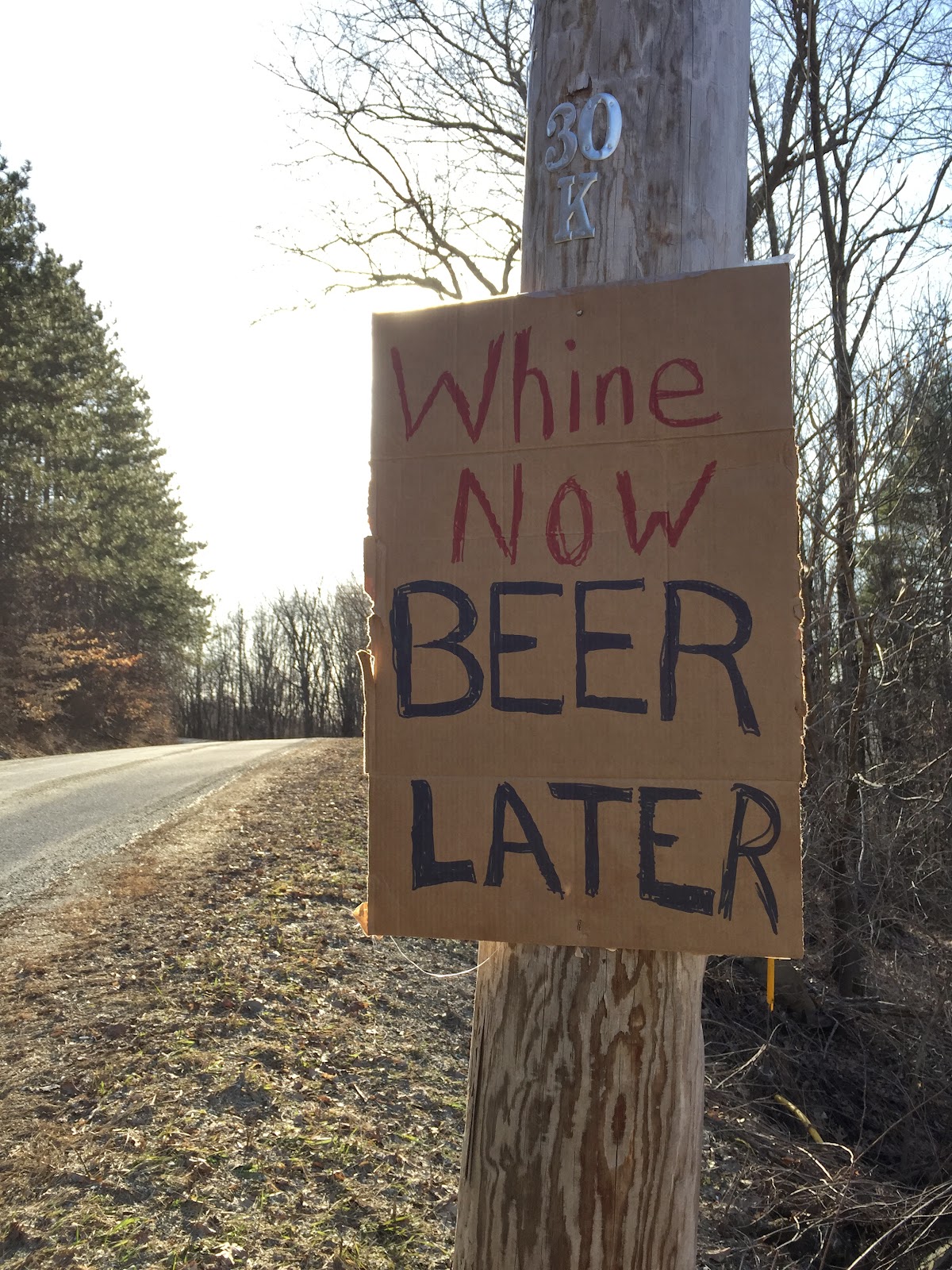
     Ascension and descension have got my attention. Ascension Rock is a geological and historical curiosity located in the Town of Hampton. The descension is at nearby Carvers Falls where the Poultney River drops over a rocky ledge. The two sites are within a few miles of each other in the northeastern corner of Washington County. This is where walking east will take you into Vermont and heading west will take you...into Vermont! Ah, the delicious fickleness of geography.
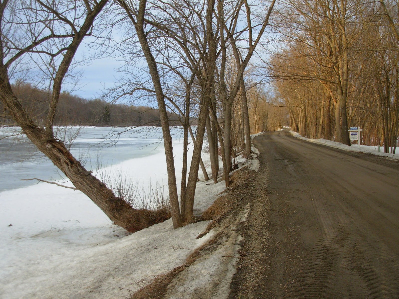
     You could spend a few pleasant hours or many days exploring the picturesque little chunk of ground that puffs into Vermont like an inflated balloon. Lying north of Rt. 4 and wrapped by the Poultney, it's a great place to bike with several loops heading out from Whitehall. If you cross over into Vermont there's a wild dirt road paralleling the river that you might need a mountain bike to ride. You can also paddle the Poultney and it's possible to go upstream on its lower reaches where it's called East Bay. Plan on seeing lots of birds and wildlife. New York State has a Wildlife Area on Co. Rt. 10 (bring a canoe) and the Nature Conservancy has protected a lot of land here on both sides of the river. This is also a great place to do geology with several interesting quarries, road cuts and exposures. It's a favorite stop on college field trips.

Poultney River

East Bay Wildlife Area

Quarry on Co. 10

     But I need to curb my enthusiasm and focus on the two places I've mentioned. Carvers Falls is the last big drop on the Poultney's long twisting trip from high up in the Taconics to Lake Champlain. The falls have a long history of hydroelectric development and there's interpretive signage with old photos that bring the site to life. Viewing platforms and trails give access to the dam, penstock and powerhouse. Put your kids on a leash because the gorge below the falls is steep and deep.


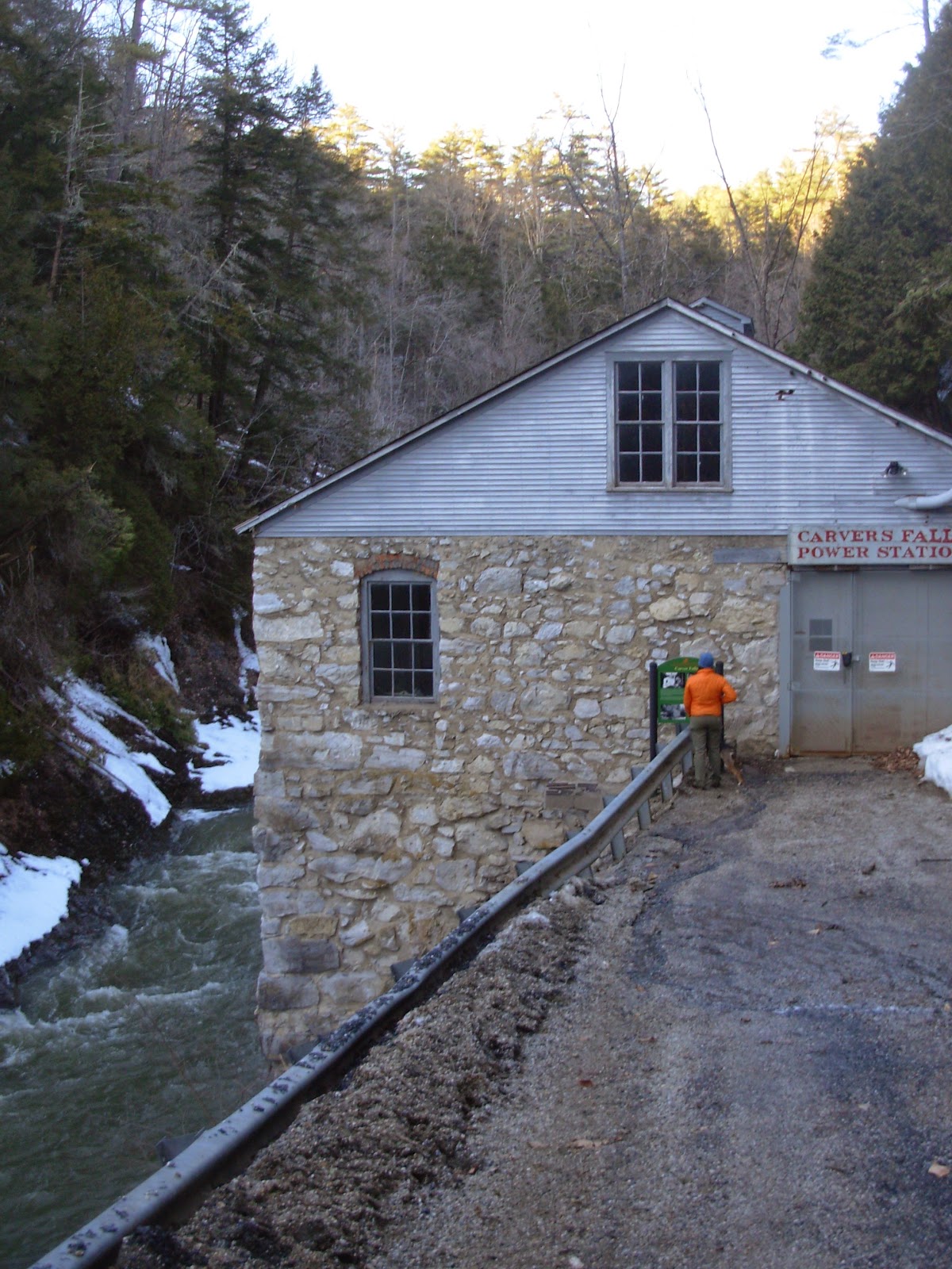
     A layered band of limestone creates the cataract and I have a feeling this might be a productive spot for naturalists in a few weeks. Limey ground often has a diversity of plants and there's a nice mix of shaded and sunny, wet and dry, open and wooded niches. Poke around here later in April and May and let me know what you find. There's also a canoe portage around the dam. The Poultney can be paddled both above and below Carvers Falls (not over it!) but there may be rapids, ledges and tree strainers so approach a river trip with caution. Below the falls and gorge there's a pool that looked like it might be good fishing and swimming.


     And you could decide to be baptized in the Poultney as many were in years gone by. One of those was an interesting man of God named William Miller. His home, farm and a chapel he built along with Ascension Rock are located on Co. Rt. 11 just north of Rt. 4 near the Vermont border. Miller's study of the Bible lead him to believe Christ would return sometime around 1843 - 1844 based on a prophecy in Daniel 8:14. A bright comet visible in daylight was seen in the spring of 1843 stirring further interest in heavenly comings and goings. By 1844 Miller had preached some 4,500 sermons and attracted a following of Millerites to his beliefs. Finally, October 22, 1844 became the accepted date of the second coming. A group assembled on an enigmatic rock exposure in back of where the chapel now stands. There they waited, and waited and waited some more. When the guest of honor didn't show up the event became known as the Great Disappointment. After being dropped from the local Baptist church Miller built the little white chapel next to his farm and this is considered the birthplace of the Adventist Movement in America. Miller died on December 20, 1849 and is buried in the small cemetery on Golf Course Road between Rt. 4 and Co. Rt. 11.


     Memoirs of William Miller by Sylvester Bliss is the standard biography but Fair Haven's Dorothy Backus Offensend has published a small booklet entitled Prophet in the Wilderness that's a short, entertaining read. It grew out of a course on Washington County history she took at ACC. She is a descendant of Miller which spiked her interest. The book includes several anecdotes better read for their humor than veracity. One involves a Millerite who went up on a hill in the evening to await the coming of the Lord. He was followed by a bunch of hooligan kids who hid in the woods till the man fell asleep. The youth creep up, spread dry hay around the slumbering figure and set it ablaze. The startled man jumped up wailing "I knew I'ld end up here. I just knew it." Presumably the boys were amused and had a good story to tell.
     In another tale, Miller went up on the roof of his house one rainy night to be closer to Jesus when he came. Wet and bedraggled, he came down in the morning and knocked on the locked door saying
"Let me in Lucy. It's your husband." To which Lucy supposedly replied "I don't have a husband. He's gone up to Heaven."

Miller Home


Miller Chapel

     Curiously, my wife Gwenne lived in the very house where Miller is said to have sat on the roof in the rain. Her family owned the Miller property for a number of years before selling it to the Adventists. The church has gatherings there and we happened to stop by one day last fall during an event. I wandered out to Ascension Rock where groups were talking, enjoying the scenery or simply absorbed in quiet contemplation. Several people asked me to take their photographs.

The Path to Ascension Rock

The Rock in Winter

Intricate Erosion

Summer View

     What you see is a sloping exposure of eroded gray bedrock maybe 100 feet to a side. It's probably dolostone which is related to limestone but with some of the calcium replaced with magnesium. It seems to have a joint pattern, and weathering has left it with a sensuously smooth surface and solution channels where water has run off.
     It's a chunk of the carbonate shelf of ancient North America, deposited nearly 500 million years ago in shallow seas bordering the continent. Related layers include the ledge at Carvers Falls, cliffs and quarries between here and Whitehall and the active open pits in Kingsbury and South Glens Falls.
     Extending from the southwest corner of Washington County in Easton diagonally up to Hampton and beyond, these carbonate rocks have been buried under strata from the east thrust over the top of them during the Taconic orogeny. Near the western edge of these darker, bent and broken Taconic rocks a hole has been eroded thru them opening a window to what lies beneath.
     Ascension Rock functions as a window in another sense. People have an innate need to understand their place in the world. We turn to myth, art and religion as well as philosophy, history and science for answers. You can see this quest for meaning playing out on the stage of our little outcrop. Geologists see clues to the formation of the physical world. Historians and students of human nature find rich material in the Miller story. The faithful feel a strong spiritual presence here while artists along with anyone who appreciates natural beauty will be inspired.
     Over the pulpit of the Miller Chapel are the words For At The Time Appointed The End Shall Be. You owe it to yourself to visit Ascension Rock before then.

Higher Ground

     Maybe there's something in the water but Washington County seems to have an extraordinarily rich diversity of spiritual communities, past and present. Here's a brief list:

     - Moravians of Camden Valley
     - Philip Embury and one of the earliest Methodist congregations in America also in Camden    
     - Miller and the beginning of Adventism in Hampton
     - The Monks and Nuns of New Skete in White Creek
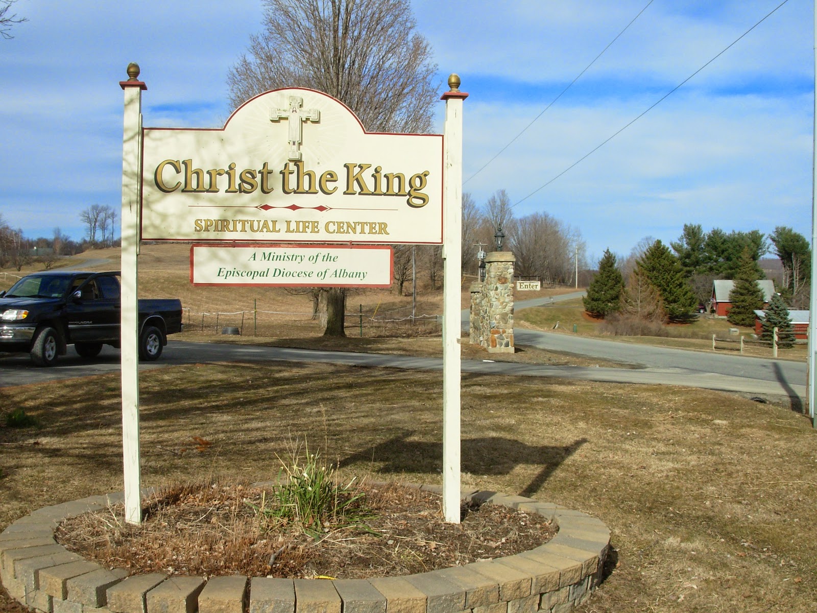
     - In Easton there's the New Covenant Community, Christ the King Spiritual Life Center and
       Easton Mountain-a community, retreat and sanctuary
     - Common Sense Farm is a 12 Tribes Community in Cambridge
     - There's a growing Amish community in the Whitehall area
     - In Vermont, but a landmark from much of Washington County is Mt. Equinox where there is a
       Carthusian Monastery