Friday, January 30, 2015

Remember This


     I've never been to Mount Rushmore. It's tough to get to South Dakota and back between milkings so I'll probably never go. But I've seen pictures. I know it's there and I know what Washington, Jefferson, Roosevelt and Lincoln looked like because the Borglum's took on the task of carving their likeness into stone. It connects us with some of the men who've shaped our country.
     There's nothing like Mount Rushmore in Washington County. Or is there. While the scale here may be smaller, the human urge to remember the past and memorialize it is strong. Think of cemeteries and the stones that bear witness to lives that might otherwise be forgotten. Sometimes I walk thru the little backroads graveyards imagining what times were like for those buried there.  In 2009 Charles and Gaynelle Moore completed the daunting task of reading and recording every marker in every cemetery in the county. You can access their research thru the Washington County Historical Society.


     Scattered across the landscape are other monuments that commemorate a variety of things: battles and historical events, buildings, roads and boundaries. Meant to remind us of the past, they are often inconspicuous and ignored. That's a shame because someone went to considerable effort to place them, creating a tangible record of our heritage. Here's a few I've come across in my travels.

Old White Church built 1797 in Salem
    

                                                                    Site of White Creek Fort in Salem
    
Mile markers along Great Northern Turnpike. Stage Road and Turnpike Roads from Buskirk to Cambridge, then Rt. 22 north.


                                                       Rexleigh Covered Bridge over the Battenkill


Shushan Veterans Memorial


Interesting rock: a breccia with limestone clasts in a dark matrix?  


A common template for historical markers seems to be a large boulder with a bronze plaque attached. Several of these boulders appear to be Chesire quartzite, a very hard metamorphic rock that crops out in a belt along the western edge of the Green Mountains in Vermont. I wonder, did people bring them into Washington County or were they transported by the glacier and left as erratics? Maybe just by being here they mark an event pre-dating our history, namely, the Ice Age.

Boundary marker on Black Hole Hollow Road

                                                                     Boundary marker on State Line Road


One of several stone pillars on Chestnut Hill Road

     Well, it's time for me to get back to the barn and I'm sure you've got things to do as well
(hopefully not involving needy cows, frozen waterers and gelled diesel fuel). Thanks for taking a minute to view my little collection of monuments. People have lived here since the ice melted 13,000 years ago. That's a lot of growing, building and, sadly, fighting. What our ancestors have done goes a long way towards defining this place. The least we can do is to take a short break from our busy lives to remember them. There's lots of reminders out there, if you look.

Tuesday, January 20, 2015

Place at the Table - Kings Donut Cart


     Sometimes there are the reasons we give for our actions while off stage, lurking in the shadows, are the real reasons. The ones we may feel a little guilty admitting to.
     I mention this because I've been driving thru Cambridge a lot recently. Often on Sunday mornings. That's when Kings Donut Cart is open on West Main Street. Now my reason for being over this way has been to check out some of the state forests in the area. But I always stop for a glazed or chocolate creme filled treat. That's only reasonable, isn't it?
     Actually, exploring place and enjoying food go well together. Both are great reasons to head to Washington County. No guilt needed, and this will be the first of several posts on my favorite spots for a bite to eat.
     The King family once operated a full time bakery across the street from Hubbard Hall. Whenever I want to
smile I just recall walking in and being enveloped in the delicious smell of bread, rolls and pies hot from the oven. Today their operation is scaled down to one morning a week (Sunday) in  the driveway of their home. It's a morning not to be missed.
     Look for the charming antique wagon and be prepared for some difficult decisions. It's amazing how many goodies they can fit in the small space and you'll have to choose. No, you can't have them all.
     They still use the original recipes developed at the bakery and the freshness and texture of the donuts approaches perfection. One (or two!) of these and you're ready for whatever "wild" Washington County can throw at you.  

Friday, January 16, 2015

Borderline Crazy

     Today's goal: #38, #39 and (just maybe) #40. But before we head out on the quest, a little meditation on the idea of "quests".
     It seems a given that people need goals to function. Our brains and bodies are wired to work towards something. It's almost a definition of what life is. At the most basic level it's food and water, shelter, sleep and sex (not necessarily in that order). On its grandest scale it might mean living a good life and getting into heaven. A common template is carefree childhood, good education, successful career, marriage, family, financial security, well earned retirement. Hard to argue with but as most of us discover, not that simple.
     No, wait! Don't click that mouse. This isn't a life coaching blog and I promise not to preach. I just want to consider the why and how of our time spent outside. Take the time honored tradition of summiting, whether it involves climbing the hill in back of your house or becoming an Adirondack 46er. Getting to the top of something is such a clearly defined goal that it has universal appeal. But even the most addicted peak-bagger will tell you it's the challenge of the ascent that they relish as much as the few minutes on high.
     Sure the hunter wants a buck but most will admit they are just happy to be in the woods and I've seen fishermen coming off the Battenkill at dusk with an empty creel and a big smile. Catch or not it was time well spent.
     I have a friend who does long distance hikes. Think the Appalachian Trail and the Pacific Crest Trail; thousands of miles, millions of steps. I'm sure it's very satisfying to finish trips like this but I'm just as sure he finds all the experiences between beginning and end to be the real reason for going.
     Back to #38, #39 and the unlikely #40. They are monuments marking the border between New York and Vermont. Topographic maps show an even one hundred starting at Vermont's southwest corner and ending where the line becomes the Poultney River and then Lake Champlain (where presumably, monuments would sink, you know, like a stone).
     They are not evenly spaced and it's hard to see a pattern in their placement. Some are near road crossings and easily examined. Others are out in the middle of nowhere. Of course, it's these latter ones that intrigue me. But most are on private land, often posted.
     #38, #39 and #40 (with a question mark) serve triple duty. They lie on the eastern boundary of New York State, Washington County and Chestnut Woods State Forest, which is public property open to all. With a place to park and no worry about trespass, the only thing between me and the monuments was some steep, confusing Taconic terrain. Irresistible.

Near Pumpkin Hook

      With monuments in mind I drove east beyond Cambridge thru Ash Grove, Pumpkin Hook and Chestnut Woods. Sounds like someplace Winnie the Pooh would live and I love it out here. It gets wilder by the mile and after passing thru a craggy notch I found the lane leading into the state forest.
 I walked past a NO ATV'S  sign following (you guessed it) ATV tracks up thru an old gravel pit and a Red Pine plantation. Beyond were open hardwoods and steadily ascending slopes. These are called the Chestnut Woods but I looked in vain for sprouts of the once majestic tree. The blight of the early 1900's took a devastating toll.

     The state forest boundary is well marked with signs and yellow paint daubs but it zig zags a bit and I wasn't always sure which side of the line was private and which public. That's a charitable way of saying I didn't know just where I was. When in doubt, go higher. Eventually I reached a rocky crest and got my bearings.

Reaching for the Sky: Ice Crystals and Oak

     The dominant feature of this state forest is a long ridge that ascends from around 1600 feet in the south to almost 2000 feet at the north end. Once I knew I was on the spine of this ridge I also knew that the state line and my target monuments were far downslope to the east. It was cold and getting colder with just a few hours of daylight left. My food cache was down to one squished banana. Of course I headed down and east towards Vermont and my destiny. Quests are like that.
     Downhill goes quick and easy and I soon came upon the familiar yellow marked trees. This was the eastern boundary of Chestnut Woods State Forest and also the VT / NY line. I had been aiming for marker #39 but it was nowhere in sight. Going north towards #40 was out of the question by this late hour. My only option was to head south connecting yellow dots and hope for #38.
     Fifteen minutes later as I crested a small knoll, there it was! Just like 2001: A Space Odyssey, but without the dramatic music, there was my monument. It was a granite obelisk about 6 - 8 inches square and standing waist high. Surveyors had splashed it with (surprise) yellow paint and a big Red Maple had toppled right next to it. It felt a little desecrated but who's complaining. At least it was here and my quest was complete.

#38 with Vermont left and New York right

     Well, almost complete. After spending a few minutes with #38 (I nicknamed her Old Faithful) I still had to follow the southern border of the state forest back to my truck before dark. This I did energized by a mission maybe 1/3 accomplished but 100% rewarding.


Thursday, January 8, 2015

Mosey Home

     We lost Grandma Moses fifty three years ago. Or did we? Certainly history tells us she died on December 13, 1961. But you never really lose someone so prolific, so possessed of such a life force and personal vision.
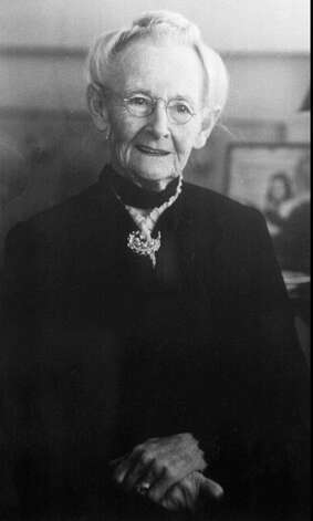
     Anna Mary Robertson Moses was the famous painter of primitive scenes who was "discovered" when in her late seventies and lived to 101, productive her entire life. She lived in Eagle Bridge, far southern Washington County on a farm that's still in her family. From this pastoral spot she went on to worldwide fame for both her art and her homespun persona.
     Wishing to reacquaint myself with this remarkable woman I took a scenic tour of Grandma Moses country recently. Hope you enjoy it here and better yet, go on your own sometime.
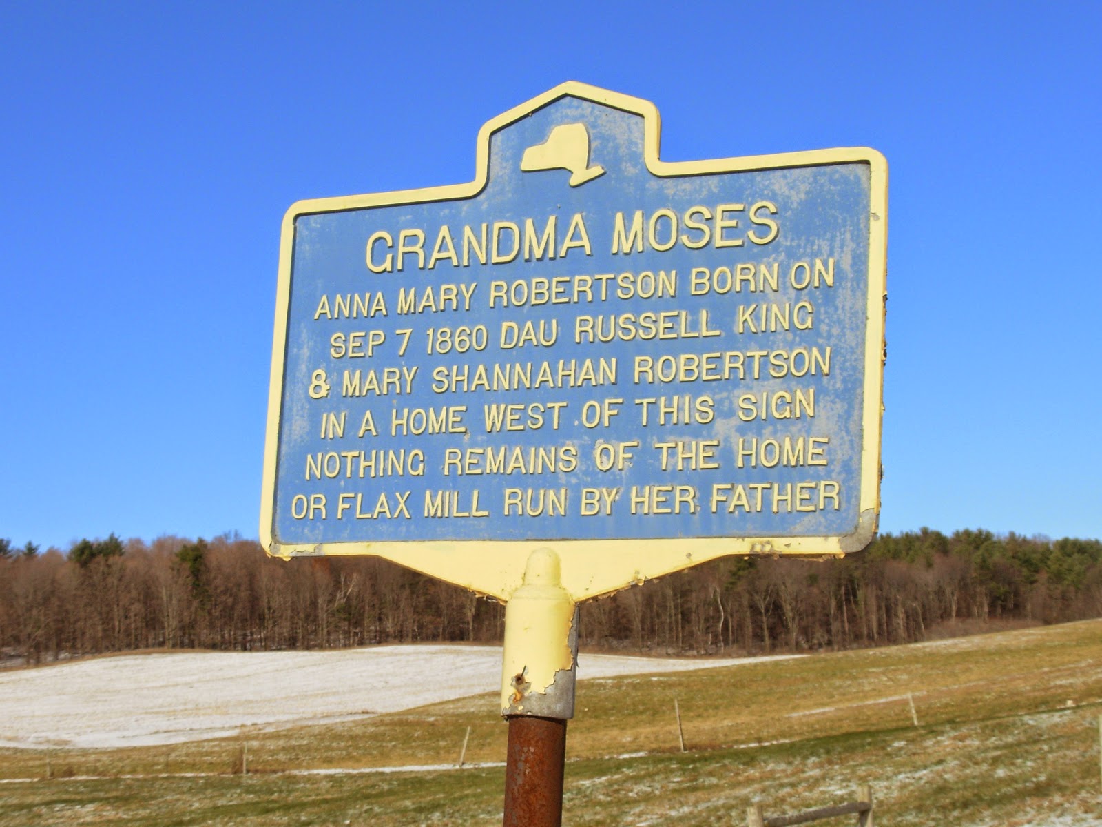
     Little Anna Mary was born on a farm in Easton just outside of Greenwich. In a painting titled Grandma Moses's Childhood Home  we see a grist mill, barns and farmhouse backed by the ever present hills of Washington County. New York State has erected an historical marker on the west side of Co. 74A that is somewhat vague, while other sources point to a location on the east side of the road for her birthplace. I called Ed Skiff, who farms here, and he set the record straight. The Moses' homestead was between 74A and 74 on a small unnamed creek that flows down along Gillis Road, across his fields and into Fly Creek. It's not real close to any modern highways so it's not a drive-by historical site. Ed says there is still a small milldam and foundation stones but all the buildings are long gone.


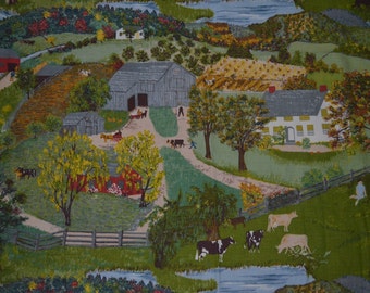
Above are fabric copies of Grandma Moses's Childhood Home

Anna began working for neighbors at the age of 12. She married Thomas Moses in 1887 and they moved to a Virginia farm where their children were born (10 in all, 5 who survived infancy). In 1905 their house burned and they were homesick for Washington County so they bought a farm in Eagle Bridge where she lived the rest of her life (she did live in Bennington, Vermont for a few years caring for family and spent her last few months in a nursing home in Hoosick Falls).

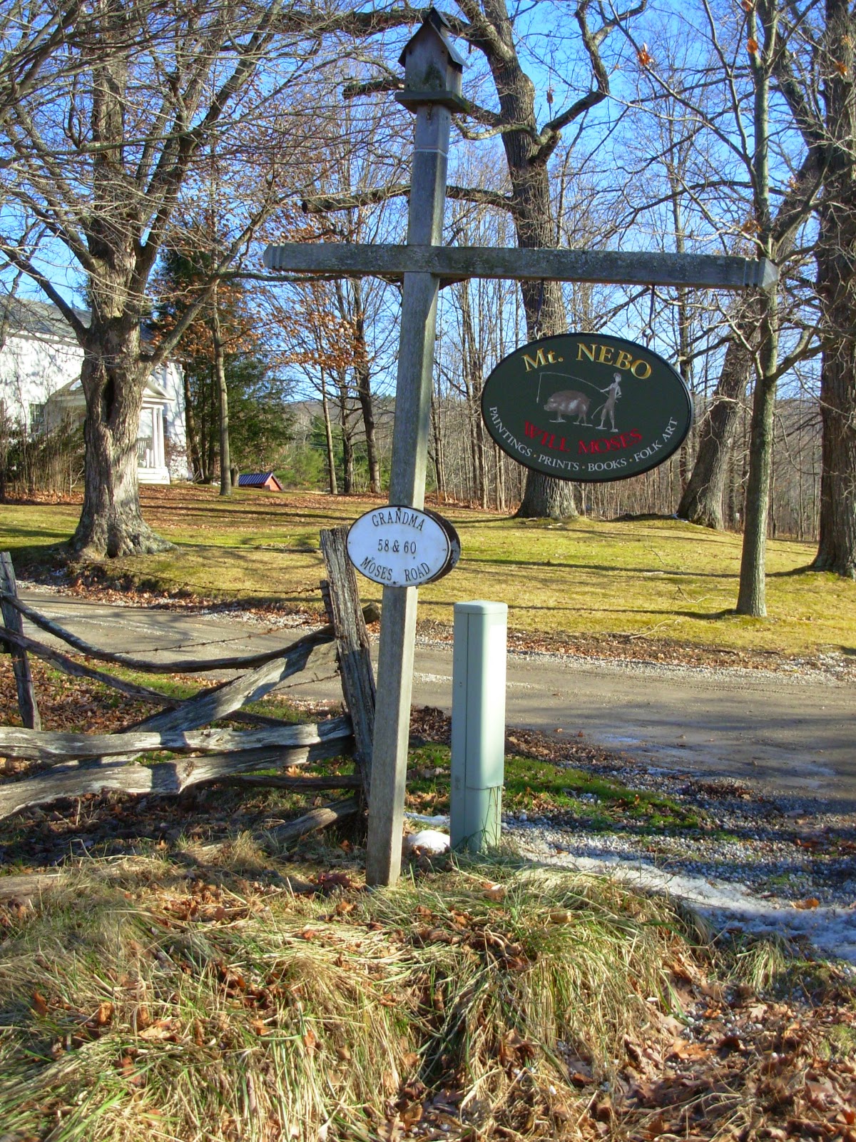
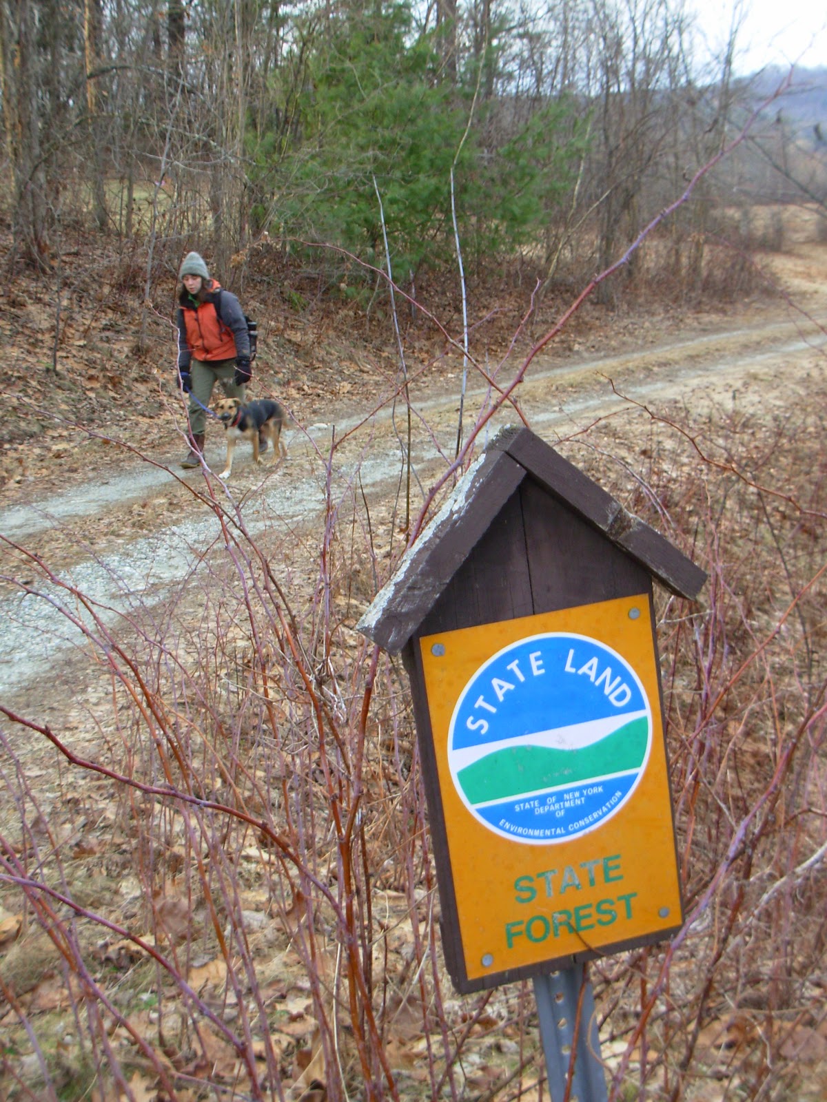
     The farm, called Mt. Nebo, is located just off Rt. 22 on (surprise!) Grandma Moses Road. The old farmhouse and adjoining red barns are recognizable from some of her paintings. You can stop and visit. Will Moses, Anna's great grandson and an accomplished folklife painter himself, has his  Mt. Nebo gallery in one of the barns, up the driveway, beyond the beef cows. It is a charming country property as you can see in the photo and painting.


Grandma Moses Going to Big City

     The rest of Grandma's farm continues as the Moses vegetable operation. Since Native American times this rich land along the Hoosic River has been highly prized. The property was recently protected thru an Agricultural Stewardship Association easement. Hopefully many more generations of Moses will farm here.
     Hoosick Falls is located a few miles south of the Moses homestead in northern Rensselaer County. In 1938 Grandma had a few paintings on display at W.D. Thomas's drug store where Louis Caldor, an art collector, happened to see them. He contacted her and arranged for a New York City show. As they say, the rest is history.
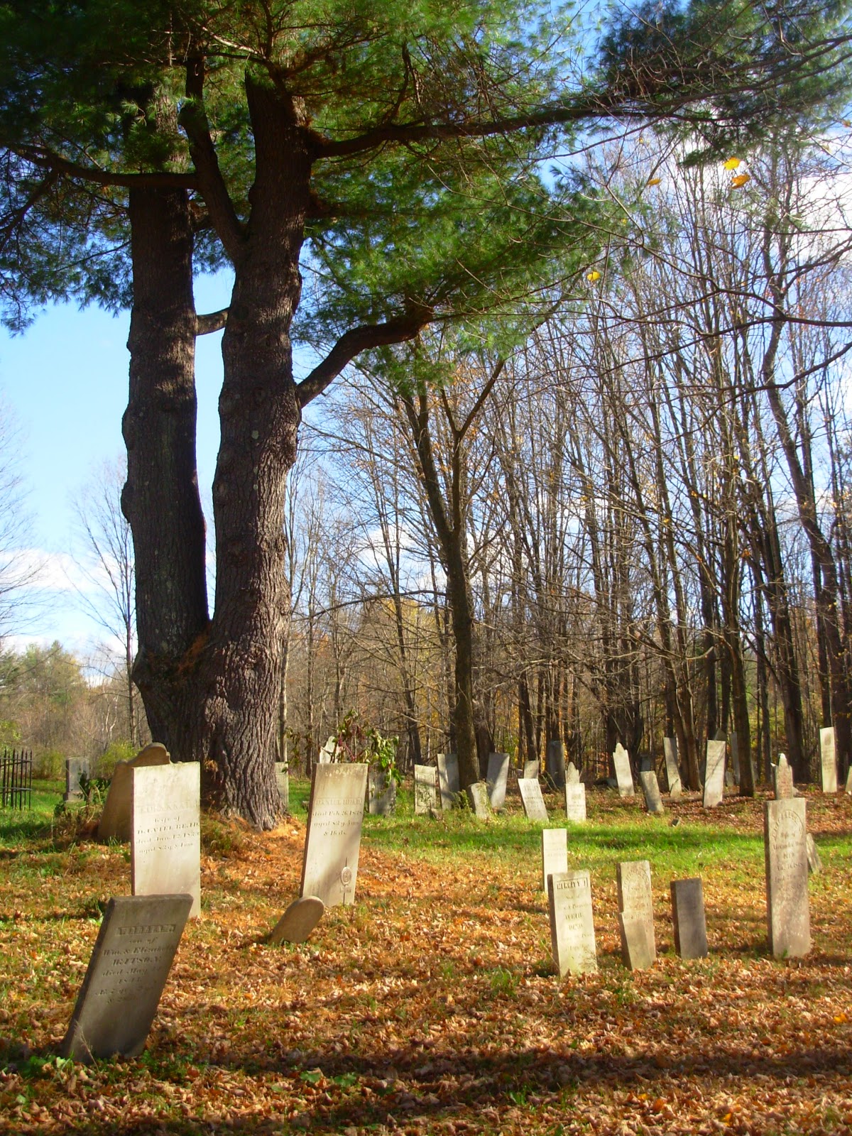
     The village is where Grandma died and is buried. You can visit her grave in Maple Grove Cemetery on the south side of town. Note the gorgeous view of the Hoosic Valley from her family's plot. It's a scene she might have painted. The inscription on her stone reads: "Her primitive paintings captured the spirit and preserved the scene of a vanishing countryside."


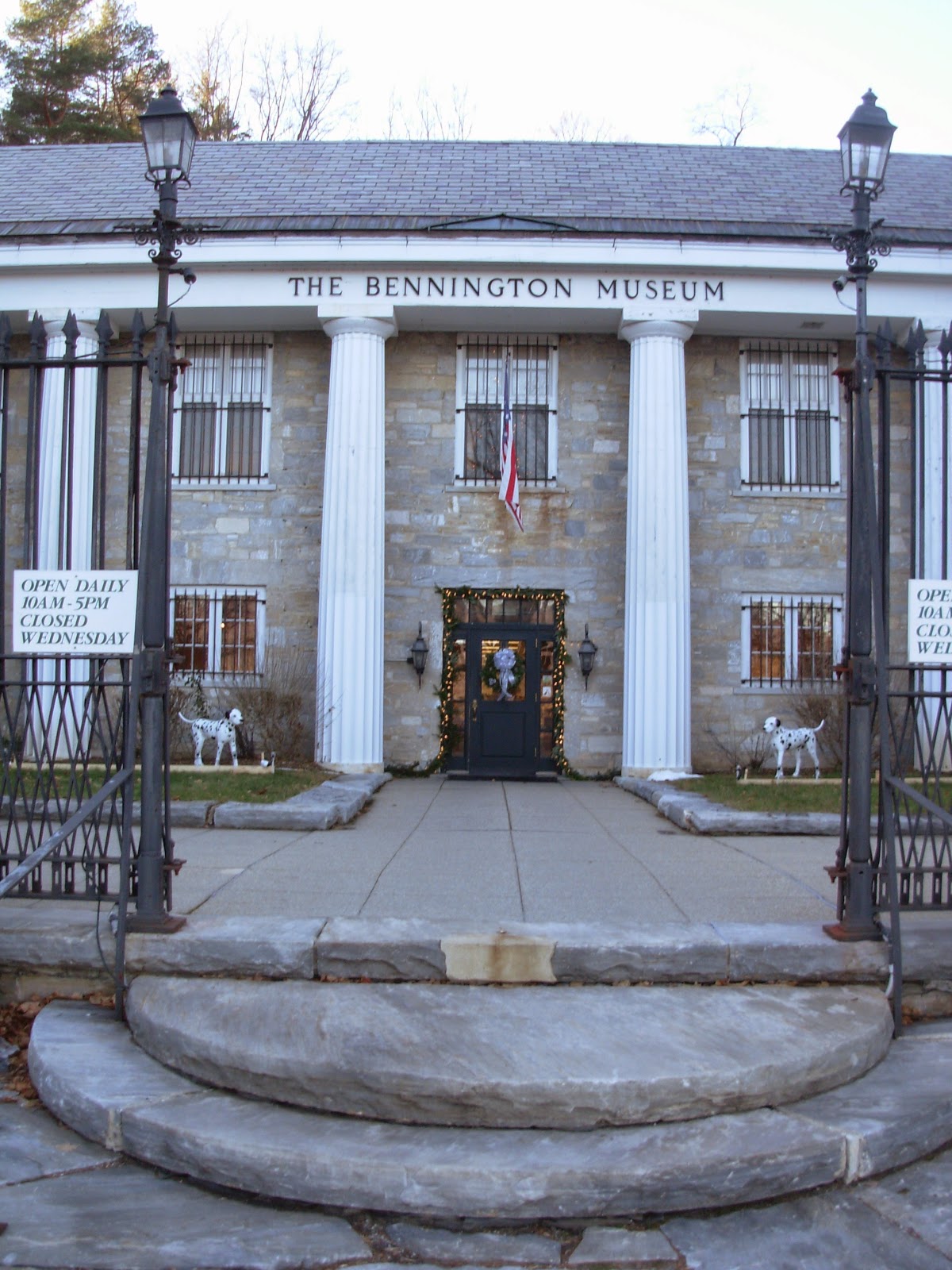
     I finished my tour in Vermont, where I visited the Bennington Museum. This imposing white marble structure has the largest single collection of Moses paintings and it's also the home of Grandma's childhood schoolhouse.


     In a gallery dedicated to her there are cases of memorabilia, the decorated tilt table where she worked and, of course, many paintings. While the patchwork landscapes of field and forest are soothingly familiar, what struck me was the activity - her scenes are full of busy animals and people at home in their world. In White Creek kids are swimming in the meandering stream and the painting titled 
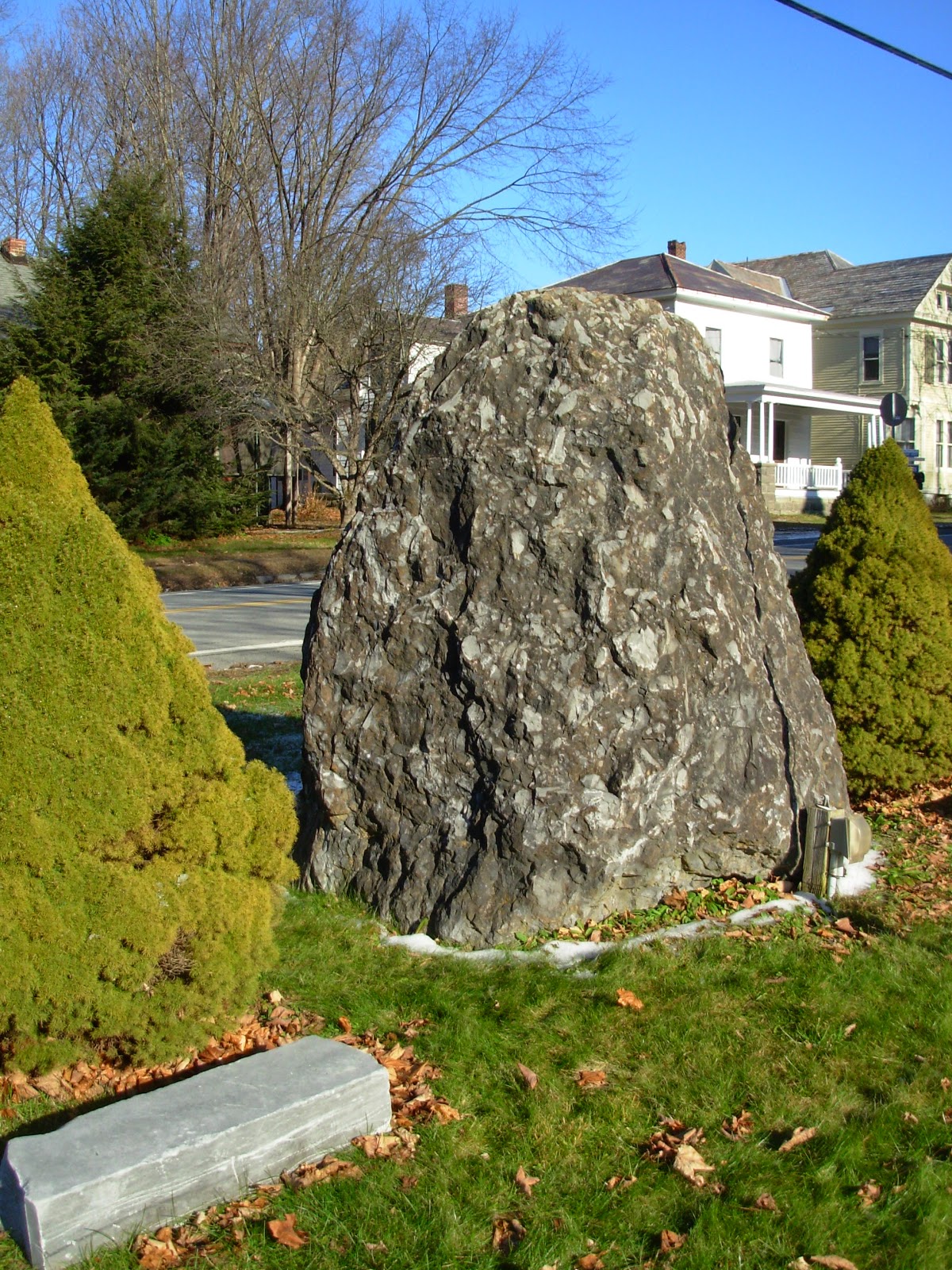
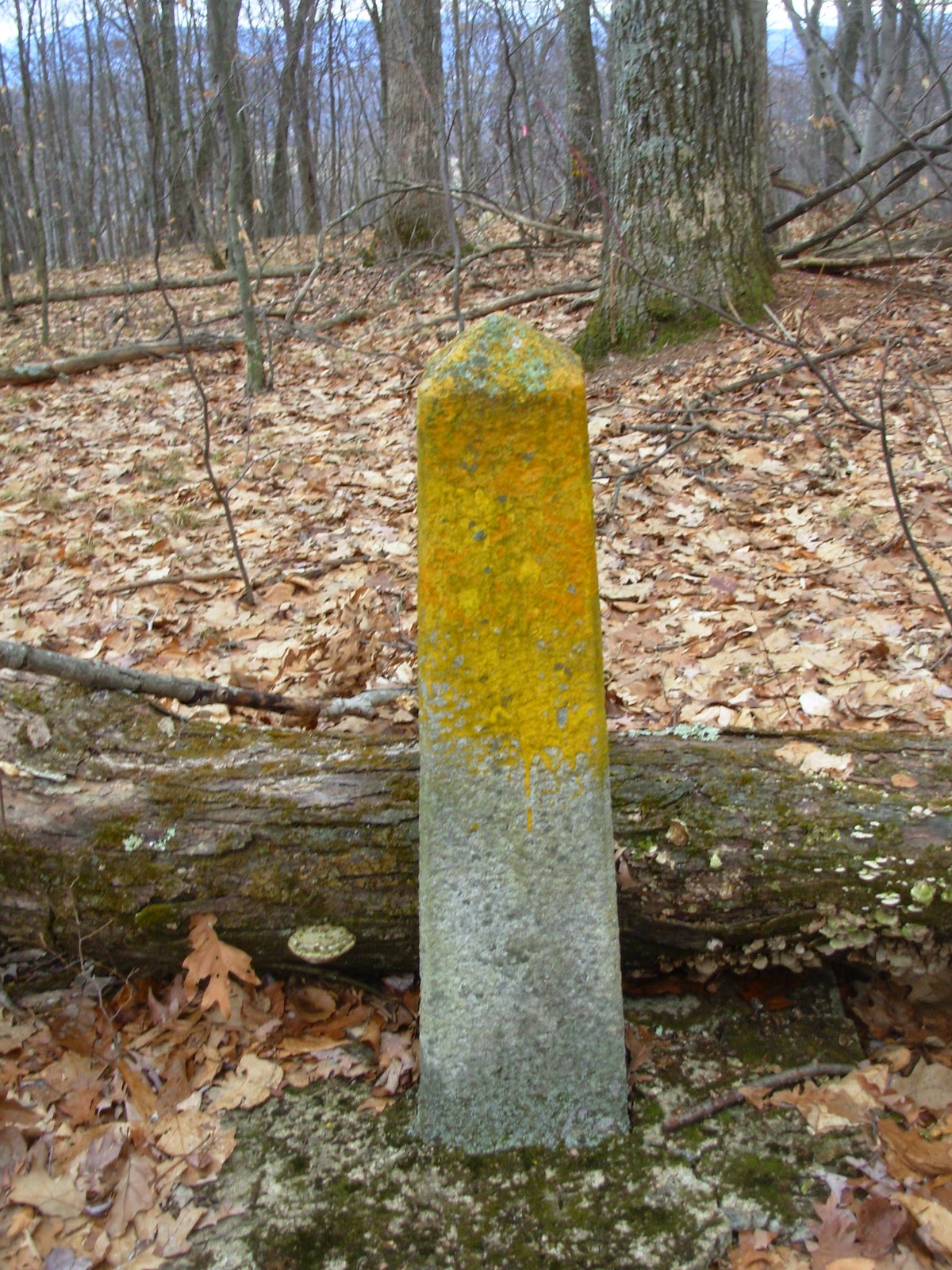
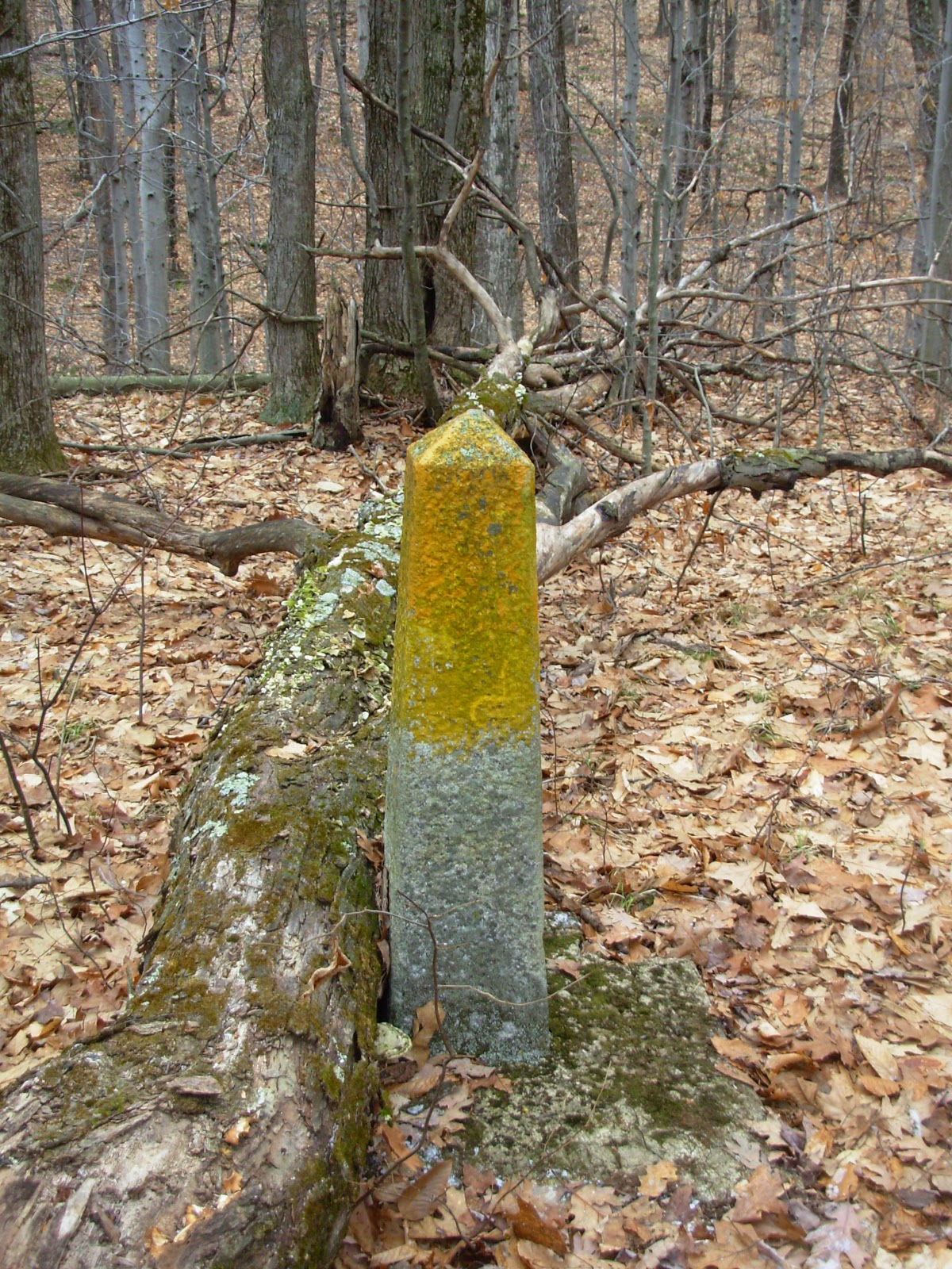
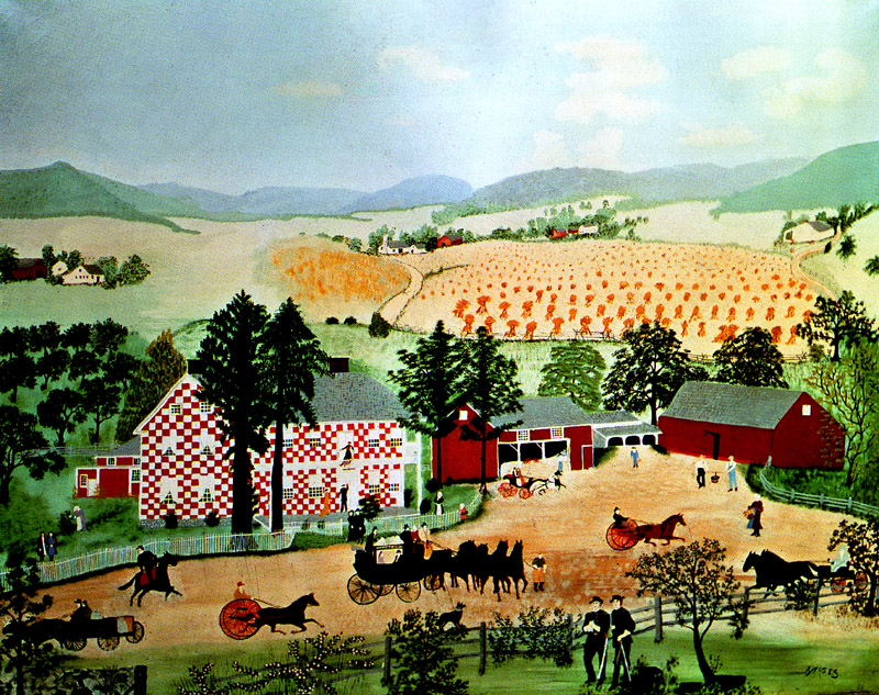
Checkered House is alive with comings and goings. The checkered house was a famous landmark painted in a red and white pattern. It was located on Turnpike Road south of Cambridge. I had stopped at the site earlier in the day. The house is gone now but there is a roadside monument. Grandma used it as subject matter many times.


     I felt a personal connection to In Harvest Time, which shows men working in a field of ripe grain. I've been told my great grandfather brought the first reaping machine to Washington County and went from farm to farm with a crew doing custom harvesting. Looking at Grandma's scene I sensed a bond across the years. It's a feeling her art evokes in many people.


"I like to paint old timey things," - Grandma Moses. Of course, that's what we liked her to paint.
Her work was labeled primitive. Today it might be more charitably called folk art. I had been to the Clark Museum in Williamstown  a week prior to viewing  the Moses paintings at Bennington. Even to an art illiterate like myself, the differences between Grandma Moses and such masters as Monet, Renoir and Degas are obvious. But she had no formal training and never claimed to be an "artist". What matters is that her paintings are just so pleasing (dare I say comforting). Of course, part of the pleasure is simple nostalgia. But there's more to it than that.
     When I wander the backroads of Washington County I keep seeing Grandma Moses pictures. She recorded what she saw and felt affection for (the "old timey things") but she also influenced what we see today. Could it be that people chose to live here because they fell in love with the landscapes she painted? And is it possible that they've built or restored their properties to look like her cheerily inviting farmyard scenes? How many artists both capture and help create the look of a place?

Inspired by Grandma?

     Moses came close to becoming a cliché. She certainly looked the part of the gentle old lady, everyones iconic grandmother who liked pretty things. But one sensed a peppery steel behind the smiling face and delicate wire rimmed glasses. She had lived a long challenging life full of hard work and her share of heartbreak. Beneath the fragile facade was a strength born of the independence and struggle inherent in farm life. Her years saw the growth of corporations and large institutions intent on pushing their products, services, programs and beliefs. But consumption and homogenization aren't for everyone. Grandma Moses gave us a different model of living, one of creation and purpose. That way of living resonates in rural Washington County to this day.


Sunday, January 4, 2015

New Year ~ Old Swamp

     I may be an old fool but I'm not foolish enough to make New Years resolutions. They just make you feel bad when you don't keep them. Still, it's good to start a new year with some fresh direction. So be it resolved: my direction in 2015 will be southeast. As in southeast Washington County where there are five state forests I hope to explore. Mt. Tom, Chestnut Woods, Battenkill, Goose Egg and Eldridge Swamp be forewarned, I'm on my way.
     I'm actually 20% there after Holly, her puppy and I spent a few hours in Eldridge Swamp on New Years Day. This is the most recently acquired of the five. The McLenithan family sold 515 acres to New York State in 2005. It's located about three miles east of Cambridge on both sides of Rt. 313. There are three small parking spots: two on the right and one on the left (heading east). The swamp is on the northwest side of the road and uplands are on the southeast. To visit the swamp park in the pull-off on the left of a downhill S bend.


     Partially overgrown fields and old logging roads can be walked but there are no marked trails. The wetland is better suited to the ambling naturalist than a hiker looking for distance. You can reach the Battenkill River in less than a mile but not necessarily a quick, easy mile. We didn't go that far.
     After several cold nights I had hoped the swamp would be frozen. Wrong again! It seems that springs feeding the area supply a constant flow that impedes freezing. While there was no snow and some solid ground there was also open water in places. When walking look for places where White Pines are growing. This tends to be higher and drier ground.


     But we had come for White Spruce, not pine. And we found them, mostly on the western side of the swamp beyond a small clearing of a few acres. Known as the Shushan Outlier, it is a relic population thriving here since post-glacial times 13,000+ years ago. It was discovered in the early 1900's by Frank Dobbins, an amateur botanist from Shushan. Since then it has attracted considerable scientific scrutiny. More information can be found in A White Spruce Outlier at Shushan, New York
by David Cook and Ralph Smith (Ecology Volume No. 40 [July, 1959] No. 3: 333-337) accessed at JSTOR.
     White Spruce is not a rare tree. It covers huge swaths of boreal forest in Canada. The population in Eldridge is significant because it's far to the south of its normal range. Coincidentally the Sycamore trees that line the Battenkill just a short distance away are near the northern limit of their range. What's that about strange bedfellows?
     Geologists say Eldridge Swamp had its origins as the last glacier was retreating. A large block of stagnant ice occupied the site damning the Battenkill Valley drainage. Sediments were deposited around the sides of the block until it eventually melted leaving a depression that became the swamp. Cold, alkaline springs flow out of the banks on the south and southwest sides creating the microclimate that allows White Spruce to persist.
     We saw one such spring while walking an old skid trail. From underneath a fallen log it bubbled up and flowed downslope before disappearing into the wetland. Other springs were once tapped for the Cambridge Village water supply and the Conservation Department fish hatchery.


     Tree huggers might want to be careful around spruces. These conifers have short, bristly needles and rough twigs and bark. Norway and Blue Spruce are common in villages, parks and cemeteries. Red Spruce covers the upper slopes of mountains. Look for it near the summits of Black and Buck on the east side of Lake George. Black Spruce is found in cold bogs. Finally, White Spruce is the common tree of the Great North Woods, and of southern Washington Counties' Eldridge Swamp.