Thursday, September 11, 2014

A swim and THE SWIM

     Lake George was working hard on Labor Day.  I know because I was working just as hard.  A stiff breeze from the south and swarms of motor boats had stirred up a chaotic chop.  It had been calm at Mossy Point when we launched our canoe and headed up lake.  But with Cooks Mountain hovering on our right and Rogers Rock starting to peek over a low shoulder things began to get interesting.  A long north-south fetch (30 - 40 miles) with steep mountains on either side creates a wind tunnel effect that can range from challenging to capsizing for small boats.
     Today it was just right.  The waves didn't have me reviewing my nonexistent life insurance policy, but they did bring a little surge of adrenaline to our adventure.  Besides, when your destination is the best beach ever, a little rough water isn't going to stop you.
     Just when my shoulders were starting to burn we rounded Black Point, skirted Turtle Rocks and landed on lovely Tiroga Beach.  We were as far northwest as you can get in Washington County (WC).  The boundary line angles across Black Point Peninsula 'til it comes to the water, then follows the shoreline south.  To the north is Essex County, to the west Warren, but the beach is a little slice of sandy heaven that WC can claim.
     On one of the hottest, most popular holidays of the summer the beach was officially closed.  The classy bathhouse was locked and there were no lifeguards.  No doubt the young people who keep watch had all gone back to college.  But the place was busy with sunbathers, kids building sand castles and little tykes splashing in the water under the watchful eyes of their parents.  I believe this is the municipal beach for the Village of Ticonderoga and to their credit no one was trying to keep people from enjoying it.  Can citizens actually assume responsibility and take care of themselves? Don't tell the politicians!
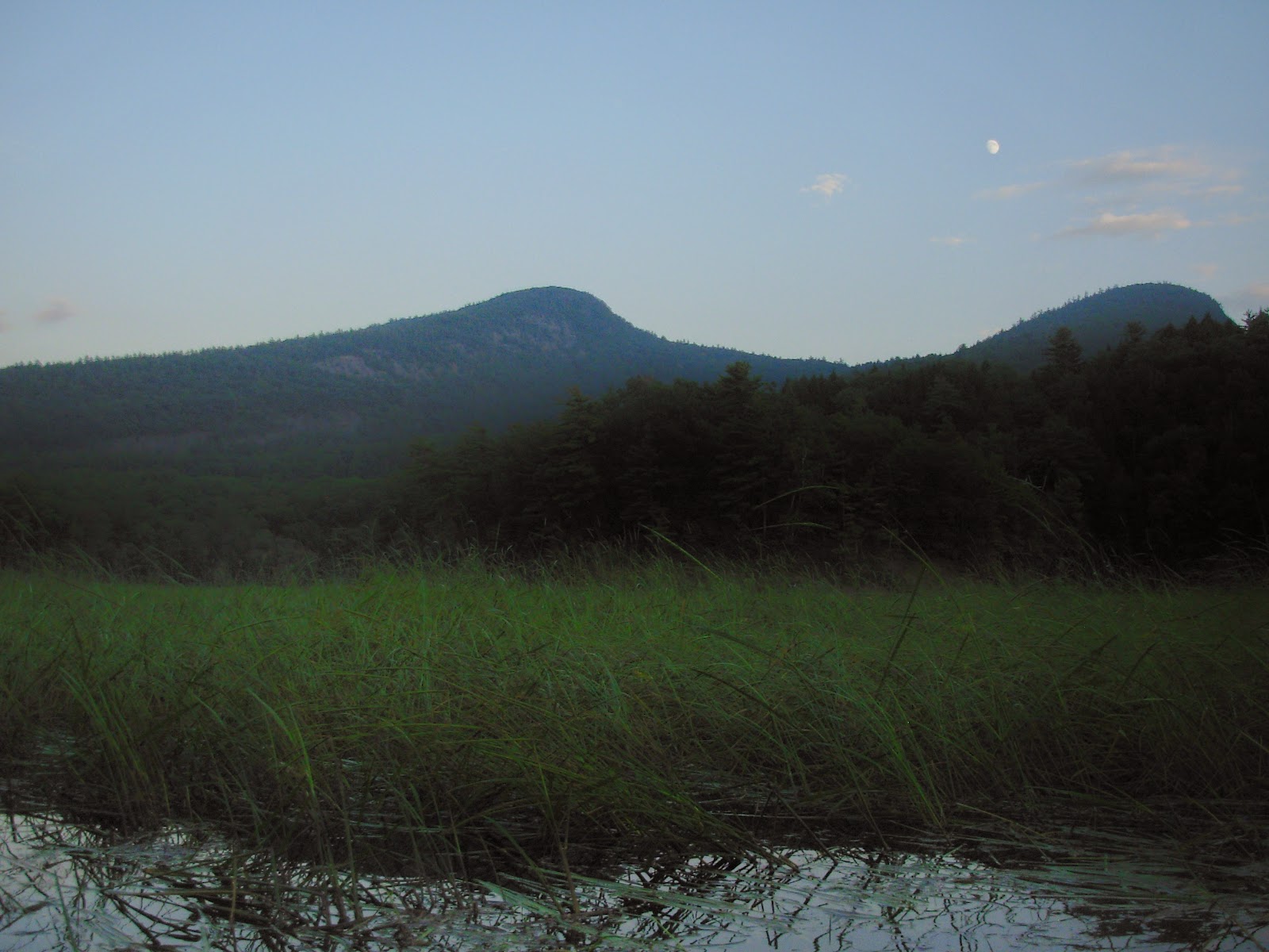
     A quick, cool swim and the energy of happy kids was ample reward for the effort of getting here.  (You don't have to come by sea of course:  Black Point Road will get you here  the American way - by car).  The setting is perfect.  Weeds Bay backed by Anthony's Nose, Record Hill and South Mountain on the east and the steep slabs of Rogers Rock across the lake.  I have great memories of paddling to its base and scooting up the Little Finger Crack years ago.  Beyond are wooded hills and broad lake stretching south to the horizon.
     In this age of large dump trucks I don't know if the beach here is natural.  The sand could be brought in or it could be built up by the lake.  The beach faces south into the prevailing wind and waves, which would tend to pile up sand against the rocky projection of Black Point.  The topo map shows a wetland across Tiroga Point road in back of the beach and this seems to be common pattern for natural lake beaches in the Adirondacks and Vermont.  It's as fascinating a place for naturalists as it is for swimmers.
     Before our beach vacation we had made a quick paddle down Ticonderoga Bay to Diane's Rock.  This small, unremarkable island is visible looking north from Mossy Point in the middle of the channel.  The rock's namesake was my mother-in-law and   Gwenne wanted to see how it was doing.   Diane Struble stood on the rock on  August 22, 1958, got greased up with the (over) eager help of several men, and began swimming south.  She didn't stop until she reached Lake George Village, 35 1/2 hours later at 10 p.m. the following day.  Thousands of people were waiting for her there and when they hoisted her onto the dock she had become the first person to swim the length of Lake George, some 42 miles. There are plaques at either end of the lake commemorating her achievement and we wanted to see the one at the start.  It's easily visible once you get close and reads:

     For a nice story and photos of Diane's swim check out Barney Fowler's Adirondack Album, Copyright, 1974, published by Outdoor Associates, 1279 Dean St. Schenectady, New York 12304.
Gwenne is currently working on an oral history project of her mom's accomplishments collecting memories of people who knew her.


     What a great Labor Day on Lake George, remembering THE SWIM and enjoying a swim.


Drafty with a chance of Cold Springs

     A lot of people go a little wild on Friday night.  The pressures of the work week; a desire to milk the weekend for all it's worth are often cited.  Last Friday Gwenne, Holly and I joined a group of Glens Falls area paddlers to go wild in the best sense of the word.  This loose knit band of adventurers organized by Maureen Coutant usually gather every other Tuesday evening for conversation and outings on area waters.  Friday's trip was a weather reschedule with Jayne Bouder and Tim and Mary Ward graciously acting as guides for a tour of the South Bay of Lake Champlain in the Town of Dresden in northern Washington County (W. C.).
     The usual starting point would be the State Boat Launch where Route 22 crosses the bay north of Whitehall.  Time constraints made that impractical so we slogged through a marshy area between South Bay Road and the lake to reach the water.  It was a hot, humid late afternoon with the sun still intense over the western ridge.  The water here is muddy, which is surprising given the steep forested hills that drain into the bay.  Apparently there are enough glacial clay deposits in the lake bed to cloud the water. While it may not encourage swimming, I'm told that the fishing is good and it's certainly a haven for wildlife.  This evening we saw deer, raccoon, beaver, eagles, ducks and frogs, and heard stories of osprey, turtles, snakes and fish sightings.  There are extensive wild rice marshes that make the area supportive for waterfowl and the cliffs that rise from the bay look like peregrin falcon habitat.
     The Adirondack Park boundary follows the western shoreline then cuts across the bay and up the opposite hillside southerly along the border between Whitehall and Fort Ann.  A big chunk of West Mountain between South Bay and the Route 4 corridor has passed from the Nature Conservancy to New York State, becoming a State Forest, but apparently not Forest Preserve since it is just outside the Blue Line.  Tim says there are 12 miles of trails here and he highly recommends a hike to North Saddle for the views and the delicate "Japanese Garden" forest communities of its steep rocky cliffs.  Other points of interest are Devils Den, a canoe camping spot on the eastern shore and Death Rock up on the ridge crest.
     This evening our destination is to paddle as far towards the head of the bay as time allows.  We find a narrow channel through the rice marshes and note that the water here has cleared, fed by sparkling Mt. Hope Brook as it tumbles off Putnam Mountain and becomes South Bay Creek.  We've been fighting a headwind, sweaty and a little worked when magically someone turns on the air conditioning. Just like that a cool, refreshing breeze slides down slope and tells us "we have arrived."  We are directly beneath the towering cliff of The Diameter with its chaotic talus apron.  Tim explains that this is Cold Spring where an icy trickle comes out of the rocks.  There are usually a few cans of beer chillin' here, leftovers from the last fishing party.  Water and air are kept cold by ice that builds up in the jumble of boulders at the cliff's base.
     This is wild with a capital W.  The huge rock face shoots skyward hundreds of feet.  It's W.C.'s own El Cap.  The detritus shed since the last glacier left town creates a unique ecosystem between cliff and water.  Moss, fern and lichen are the first hardy colonizers of this harsh environment.  We linger awhile enthralled by the unique place we're in.  Too soon, the sky goes orange and pink and it's time to head back.
     From previous visits I remember a clean, winding stream if you go beyond Cold Spring.  There were silver maple and ostrich fern swamps, beaver dams and trees across the stream until all but the most obsessive turn around, sated with the verdant aliveness of the place.
     Tim and Mary live in a hand crafted rustic house nestled above the bay, commute by canoe and are great sources of information about the area.  Thanks to them and Jayne and Maureen for a memorable trip.